Near Winfield in Scott County, Tennessee — The American South (East South Central)
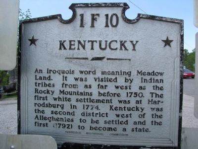
Tennessee / Kentucky
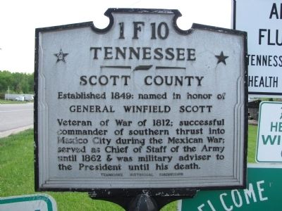
Scott County
Established 1849: named in honor of
General Winfield Scott
Erected by Tennessee Historical Commission. (Marker Number 1 F 10.)
Topics and series. This historical marker is listed in these topic lists: Political Subdivisions • Settlements & Settlers • War of 1812 • War, Mexican-American. In addition, it is included in the Tennessee Historical Commission series list. A significant historical year for this entry is 1849.
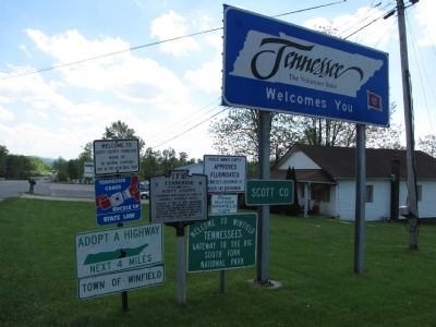
Location. 36° 35.736′ N, 84° 26.356′ W. Marker is near Winfield, Tennessee, in Scott County. Marker is on Scott Highway (U.S. 27) 0.3 miles south of State Highway 759, on the right when traveling south. Marker is adjacent to the Tennessee state line marker and is part of a large group of signs. See picture below. Touch for map. Marker is in this post office area: Winfield TN 37892, United States of America. Touch for directions.
Other nearby markers. At least 8 other markers are within 14 miles of this marker, measured as the crow flies. Edward "Eddie" Ward (approx. 4.6 miles away in Kentucky); Stearns Coal & Lumber Company (approx. 7.4 miles away in Kentucky); Sandstone Tree Stump (approx. 7˝ miles away in Kentucky); Historic Stearns Kentucky (approx. 7˝ miles away in Kentucky); Princess Cornblossom (approx. 7.6 miles away in Kentucky); First Kentucky Oil Well / Martin Beaty (Beatty) (approx. 9.2 miles away in Kentucky); McCreary County, 1912 (approx. 9.2 miles away in Kentucky); Col. Joseph S. Cecil (approx. 13.2 miles away).
Credits. This page was last revised on September 15, 2018. It was originally submitted on May 7, 2010, by Lee Hattabaugh of Capshaw, Alabama. This page has been viewed 899 times since then and 29 times this year. Photos: 1, 2, 3, 4. submitted on May 7, 2010, by Lee Hattabaugh of Capshaw, Alabama. • Kevin W. was the editor who published this page.


