Pine Knot in McCreary County, Kentucky — The American South (East South Central)
Edward "Eddie" Ward
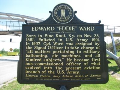
Born in Pine Knot, Ky. on Nov. 23, 1881. Enlisted in U.S. Army, 1901. In 1907, Cpl. Ward was assigned by the Signal Officer to take charge of "all matters pertaining to military ballooning, air machines, and all kindred subjects." He became first non-commissioned officer of what evolved into the present aviation branch of the U.S. Army.
Bluegrass Chapter, Army Aviation Assoc. of America
Marker reverse:
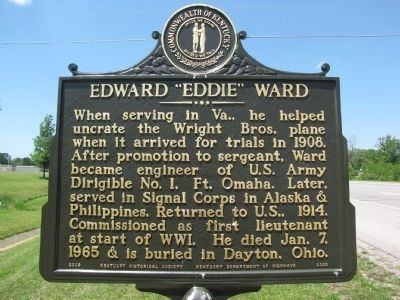
When serving in Va., he helped uncrate the Wright Bros. plane when it arrived for trials in 1908. After promotion to sergeant, Ward became engineer of U.S. Army Dirigible No. 1, Ft. Omaha. Later, he served in Signal Corps in Alaska & Philippines. Return to U.S., 1914. Commissioned as first lieutenant at start of WWI. He died Jan. 7, 1965 & is buried in Dayton, Ohio.
Erected 2009 by Kentucky Historical Society/Kentucky Department of Highways. (Marker Number 2300.)
Topics and series. This historical marker is listed in these topic lists: Air & Space • War, World I. In addition, it is included in the Kentucky Historical Society series list. A significant historical month for this entry is January 1817.
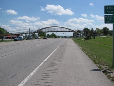
Location. 36° 39.745′ N, 84° 26.373′ W. Marker is in Pine Knot, Kentucky, in McCreary County. Marker is at the intersection of U.S. 27 and Old U.S. 27 (State Highway 92), on the right when traveling south on U.S. 27. Marker is just north of the pedestrian overpass bridge across US 27 near the school. Touch for map. Marker is in this post office area: Pine Knot KY 42635, United States of America. Touch for directions.
Other nearby markers. At least 8 other markers are within 14 miles of this marker, measured as the crow flies. Stearns Coal & Lumber Company (approx. 3.2 miles away); Historic Stearns Kentucky (approx. 3.3 miles away); Sandstone Tree Stump (approx. 3.3 miles away); Princess Cornblossom (approx. 3.4 miles away); Tennessee / Kentucky (approx. 4.6 miles away in Tennessee); First Kentucky Oil Well / Martin Beaty (Beatty) (approx. 4.7 miles away); McCreary County, 1912 (approx. 4.7 miles away); Cumberland Falls MoonBow (approx. 13.3 miles away).
Credits. This page was last revised on November 20, 2019. It was originally submitted on May 7, 2010, by Lee Hattabaugh of Capshaw, Alabama. This page has been viewed 1,457 times since then and 24 times this year. Photos: 1, 2, 3. submitted on May 7, 2010, by Lee Hattabaugh of Capshaw, Alabama. • Kevin W. was the editor who published this page.


