Ajo in Pima County, Arizona — The American Mountains (Southwest)
The Ajo Mining District
Photographed by Bill Kirchner, May 12, 2010
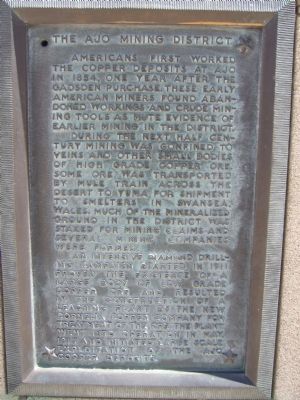
1. The Ajo Mining District Marker
During the next half century mining was confined to veins and other small bodies of high grade copper ore. Some ore was transported by mule train across the desert to Yuma for shipment to smelters in Swansea, Wales. Much of the mineralized ground in the district was staked for mining claims and several mining companies were formed.
An intensive diamond drilling campaign started in 1911 proved the existence of a large body of low grade copper ore and resulted in the construction of a leaching plant by the New Cornelia Copper Company for treatment of the ore. The plant went into operation in May, 1917 and initiated large scale exploitation of the land copper deposits.
Topics. This historical marker is listed in these topic lists: Industry & Commerce • Natural Resources • Notable Places. A significant historical month for this entry is May 1917.
Location. 32° 22.339′ N, 112° 51.753′ W. Marker is
this page online

Regionally, this marker is in the Sky Islands, in the Sonoran Desert, in the Phoenix Metropolitan Area, in the Tucson Metro Metropolitan Area, and in the Tohono O’odham Nation. It is also in the American Borderlands and in the Southwest. Globally, it is in North America, the Western Hemisphere, the Western World, and the Anglosphere. Historically, it finds itself in what was once New Spain and also the Gadsden Purchase.
Other nearby markers. At least 6 other markers are within 2 miles of this marker, measured as the crow flies: The City of Ajo (here, next to this marker); A Company Town Designed in Style (about 500 feet away, measured in a direct line); Ajo Train Depot (about 500 feet away); Curley School (about 700 feet away); The Mine Manager's House (approx. half a mile away); Old Clarkston Cemetery (approx. 1½ miles away).
More about this marker. Marker is mounted on the base of
Photographed by Bill Kirchner
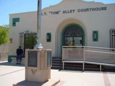
2. The Ajo Mining District Marker
This marker is mounted on the right side of the flag pole base.
Also see . . . New Cornelia Mine. A Wikipedia article on the Open pit mine. (Submitted on May 18, 2010.)
Photographed by Bill Kirchner
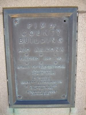
3. Pima County Building
Plaque mounted on the front of the flagpole base
Pima County Building
Ajo, Arizona
Erected 1949 - 50
Board of Supervisors
Chairman
J. Homer Boyd
Members
G. T. Alley
Lambert Kautenburger
D. O. Norton & Son
Contractors
Blanton & Cole
Architects
Ajo, Arizona
Erected 1949 - 50
Board of Supervisors
Chairman
J. Homer Boyd
Members
G. T. Alley
Lambert Kautenburger
D. O. Norton & Son
Contractors
Blanton & Cole
Architects
Credits. This page was last revised on July 26, 2018. It was originally submitted on May 17, 2010, by Bill Kirchner of Tucson, Arizona. This page has been viewed 1,411 times since then and 34 times this year. Photos: 1. submitted on May 17, 2010, by Bill Kirchner of Tucson, Arizona. 2, 3. submitted on May 16, 2010, by Bill Kirchner of Tucson, Arizona. • Syd Whittle was the editor who published this page.
