Ridgefield in Fairfield County, Connecticut — The American Northeast (New England)
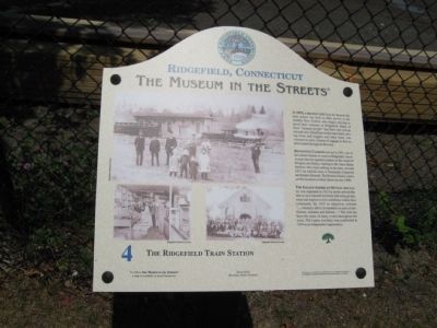
The Ridgefield Train Station
Ridgefield, Connecticut
— The Museum in the Streets —
In 1870, A Branch Line from the Branchville train station was built to offer service to the wealthy New Yorkers who began arriving to spend their summers in Ridgefield. Many of these "summer people" had their own private railroad cars. Chauffeurs would meet them, driving horse and buggies and other fancy conveyances to carry volumes of luggage to their estates located throughout the town.
Benvenuto Carboni arrived in 1901, one of the earliest Italians to come to Ridgefield. Several years later he opened a market on the corner of Prospect and Bailey, catering to the many Italian families who were settling in the area. Around 1915, he sold his store to Nazzareno Gasperini and Ernesto Brunetti. The Brunetti family continued the business on Main Street into the 1980s.
The Italian-American Mutual Aid Society was organized in 1913 by newly arrived Italians so as to become involved with town government and improve civic conditions within their community. By 1915 its objectives included "… voluntary aid to its members in case of misfortune, sickness and distress…" The club has been the scene of many events throughout the years. The Ladies Auxiliary was established in 1934 as an independent organization.
Erected 2008 by The Museum in the Streets®. (Marker Number 4.)
Topics and series. This historical marker is listed in these topic lists: Fraternal or Sororal Organizations • Industry & Commerce • Railroads & Streetcars. In addition, it is included in the The Museum in the Streets®: Ridgefield, Connecticut series list. A significant historical year for this entry is 1870.
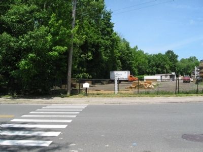
Location. 41° 17.026′ N, 73° 29.787′ W. Marker is in Ridgefield, Connecticut, in Fairfield County. Marker is at the intersection of Prospect Street and Bailey Avenue, on the right when traveling west on Prospect Street. Touch for map. Marker is in this post office area: Ridgefield CT 06877, United States of America. Touch for directions.
Other nearby markers. At least 8 other markers are within walking distance of this marker. Bootlegging and the Historical Society (about 400 feet away, measured in a direct line); Ridgefield (about 600 feet away); Smith Tavern – A Colonial Meeting Place (about 600 feet away); Main Street in the Late 1800s (about 600 feet away); Ballard Park (about 600 feet away); The Battle of Ridgefield (about 700 feet away); The Spotting Tower and Railroad Warehousing (about 700 feet away); The Village in the 1900s (about 700 feet away). Touch for a list and map of all markers in Ridgefield.
Credits. This page was last revised on August 7, 2023. It was originally submitted on June 6, 2010, by Michael Herrick of Southbury, Connecticut. This page has been viewed 1,452 times since then and 43 times this year. Photos: 1, 2. submitted on June 6, 2010, by Michael Herrick of Southbury, Connecticut.

