Wilkes-Barre in Luzerne County, Pennsylvania — The American Northeast (Mid-Atlantic)
Wilkes-Barre
Photographed by Paul Crumlish, June 16, 2010
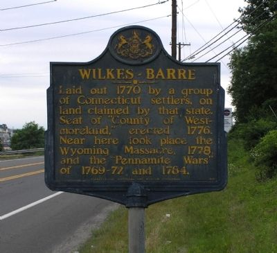
1. Wilkes-Barre Marker
Laid out 1770 by a group of Connecticut settlers, on land claimed by that state. Seat of "County of Westmoreland," erected 1776. Near here took place the Wyoming Massacre, 1778, and the "Pennamite Wars" of 1769-72 and 1784.
Erected 1949 by Pennsylvania Historical and Museum Commission.
Topics and series. This historical marker is listed in these topic lists: Settlements & Settlers • War, US Revolutionary. In addition, it is included in the Pennsylvania Historical and Museum Commission (PHMC) series list. A significant historical year for this entry is 1770.
Location. 41° 13.73′ N, 75° 52.396′ W. Marker is in Wilkes-Barre, Pennsylvania, in Luzerne County. It is at the intersection of Wilkes-Barre Township Boulevard (Business Pennsylvania Route 309) and East Northampton Street, on the right when traveling north on Wilkes-Barre Township Boulevard. The marker is located between Wilkes-Barre Township Boulevard and the northbound exit ramp for East Northampton Street. Touch for map. Marker is at or near this postal address: 700 Wilkes Barre Township Blvd, Wilkes Barre PA 18702, United States of America. Touch for directions.

Regionally,
this page online
Other nearby markers. At least 8 other markers are within one mile of this marker, measured as the crow flies: Saint Mary of the Dormition Byzantine Catholic Church Bell (approx. 0.3 miles away); Saint John the Baptist Byzantine Catholic Church (approx. 0.3 miles away); World War II Memorial (approx. 0.4 miles away); World War Memorial (approx. 0.4 miles away); Wilkes-Barre Township War Memorial (approx. 0.4 miles away); Wards III, VI, and IX World War II Honored Dead (approx. half a mile away); Ellis W. Roberts, Ph.D. (approx. 0.8 miles away); St. Mary's High School (approx. one mile away). Touch for a list and map of all markers in Wilkes-Barre.
Related markers. Click here for a list
Photographed by Paul Crumlish, June 16, 2010
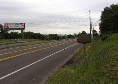
2. Wide view of the Wilkes-Barre Marker
Looking north across the skyline of Wilkes-Barre's neighborhoods.
Also see . . . A history of Wilkes-Barré, Luzerne County, Pennsylvania. Internet Archive website entry:
from its first beginnings to the present time, including chapters of newly-discovered early Wyoming Valley history, together with many biographical sketches and much genealogical material (1909) by Oscar Jewell Harvey and Ernest Gray Smith (Submitted on June 22, 2010, by PaulwC3 of Northern, Virginia.)
Credits. This page was last revised on July 22, 2024. It was originally submitted on June 22, 2010, by PaulwC3 of Northern, Virginia. This page has been viewed 1,316 times since then and 38 times this year. Photos: 1, 2. submitted on June 22, 2010, by PaulwC3 of Northern, Virginia. • Craig Swain was the editor who published this page.
