Bound Brook in Somerset County, New Jersey — The American Northeast (Mid-Atlantic)
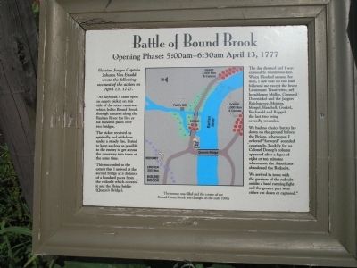
Battle of Bound Brook
Opening Phase: 5:00 – 6:30 am April 13, 1777
“At daybreak I came upon an empty picket on this side of the stone causeway which led to Bound Brook through a marsh along the Raritan River for five or six hundred paces over two bridges.
The picket received us spiritedly and withdrew under a steady fire. I tried to keep as close as possible to the enemy to get across the causeway into town at the same time.
This succeeded to the extent that I arrived at the second bridge at a distance of a hundred paces from the redoubt which covered it and the flying bridge (Queen’s Bridge).
The day dawned and I was exposed to murderous fire. When I looked around for men, I saw that no one had followed me except the brave Lieutenant Trautvetter, my hornblower Muller, Corporal Doernickel and the Jaegers Reichmeyer, Meister, Mergel, Hachell, Gurkel, Buchwald and Ruppel: the last two being severely wounded.
We had no choice but to lay down on the ground before the Bridge, whereupon I ordered “forward” sounded constantly. Luckily for us Colonel Donop’s column appeared after a lapse of eight or ten minutes whereupon the Americans abandoned the Redoubt.
We arrived in town with the garrison of the redoubt amidst a hard running fight and the greater part were either cut down or captured.”
Topics. This historical marker is listed in this topic list: War, US Revolutionary. A significant historical month for this entry is April 1836.
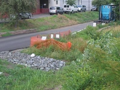
Location. 40° 33.623′ N, 74° 31.621′ W. Marker is in Bound Brook, New Jersey, in Somerset County. Marker is on Railroad Avenue east of S Main Street, on the right when traveling east. Touch for map. Marker is in this post office area: Bound Brook NJ 08805, United States of America. Touch for directions.
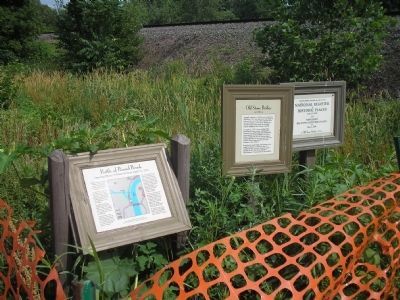
Other nearby markers. At least 8 other markers are within walking distance of this marker. Old Stone Bridge (here, next to this marker); a different marker also named Battle of Bound Brook (about 600 feet away, measured in a direct line); Queen’s Bridge (about 600 feet away); Bound Brook World War I Memorial (approx. 0.2 miles away); Van Horn Plaza (approx. 0.2 miles away); Battle of Boundbrook (approx. 0.2 miles away); Locks on the D&R Canal (approx. ¼ mile away); Delaware & Raritan Canal State Park (approx. ¼ mile away). Touch for a list and map of all markers in Bound Brook.
More about this marker. The center of the marker contains a map showing American and British troop positions and the location of the marker.
Also see . . .
1. The Battle of Bound Brook. The American Revolutionary War website. (Submitted on June 26, 2010, by Bill Coughlin of Woodland Park, New Jersey.)
2. The Battle of Bound Brook. New Jersey’s Great Northwest Skyways. (Submitted on June 26, 2010, by Bill Coughlin of Woodland Park, New Jersey.)
Credits. This page was last revised on February 3, 2021. It was originally submitted on June 25, 2010, by Bill Coughlin of Woodland Park, New Jersey. This page has been viewed 1,148 times since then and 31 times this year. Last updated on January 31, 2021, by Carl Gordon Moore Jr. of North East, Maryland. Photos: 1. submitted on June 25, 2010, by Bill Coughlin of Woodland Park, New Jersey. 2, 3. submitted on June 26, 2010, by Bill Coughlin of Woodland Park, New Jersey. 4. submitted on April 12, 2014, by Bill Coughlin of Woodland Park, New Jersey. • Bill Pfingsten was the editor who published this page.


