Marker Logo HMdb.org THE HISTORICAL
MARKER DATABASE
“Bite-Size Bits of Local, National, and Global History”
Near Valley in Avery County, North Carolina — The American South (South Atlantic)
 

Overmountain Men


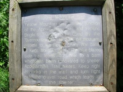
Overmountain Men Marker image. Click for full size.
Photographed By Julie Szabo, June 4, 2007
1. Overmountain Men Marker
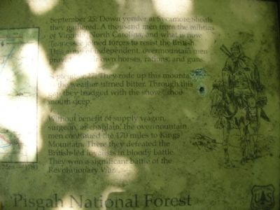
Inscription. Appalachian Trail, Yellow Mountain Gap. Yellow Mountain Gap is the junction of the Appalachian Trail and Historic Bright’s Trace, route used by the “Overmountain Men” to cross the mountain enroute to the Revolutionary War battle at King's Mountain, S.C. The blue-blazed side trail leads 0.2 miles to a barn which has been renovated to shelter Appalachian Trail hikers. Keep right at forks in the trail and turn right onto the gravel road which leads to the shelter.
 
Topics. This historical marker is listed in this topic list: War, US Revolutionary.
 
Location. 36° 7.473′ N, 82° 3.207′ W. Marker is near Valley, North Carolina, in Avery County. Marker can be reached from Roaring Creek Road. Plaques are on the Appalachian Trail in the Pishah National Forest. Closest town is Roan Mountain, Tennessee. Touch for map. Marker is in this post office area: Newland NC 28657, United States of America. Touch for directions.
 
Other nearby markers. At least 8 other markers are within 8 miles of this marker, measured as the crow flies. Peg Leg Iron Ore Mine (approx. 3.9 miles away in Tennessee); First Night's Encampment (approx. 4.3 miles away in Tennessee); Yellow Mountain Road (approx. 4.7 miles away); Cranberry Mines (approx. 5.4 miles away); Cranberry Iron Mine
Paid Advertisement
Click on the ad for more information.
Please report objectionable advertising to the Editor.
Click or scan to see
this page online
(approx. 5.4 miles away); Avery County Salute to Veterans (approx. 7½ miles away); Avery County Veterans Monument (approx. 7.6 miles away); Former Avery County Jail (approx. 7.6 miles away).
 
Regarding Overmountain Men. The battle of King’s Mountain was a turning point of the Revolutionary War in the south.
 
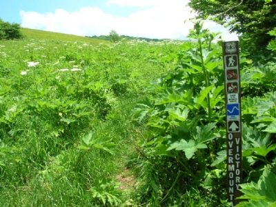
Overmountain Men Marker image. Click for full size.
Photographed By Julie Szabo, June 4, 2007
2. Overmountain Men Marker
Overmountain Men Marker image. Click for full size.
Photographed By Julie Szabo, June 4, 2007
3. Overmountain Men Marker
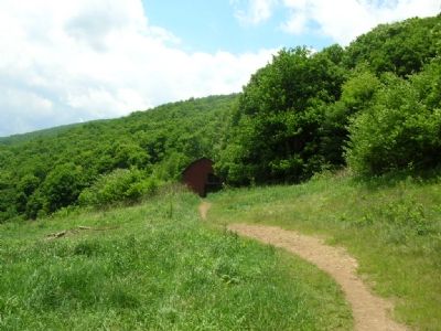
The Overmountain Shelter image. Click for full size.
Photographed By Julie Szabo, June 4, 2007
4. The Overmountain Shelter
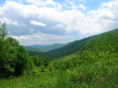
The view image. Click for full size.
Photographed By Julie Szabo, June 4, 2007
5. The view
 
 
Credits. This page was last revised on June 16, 2016. It was originally submitted on November 2, 2007, by Julie Szabo of Oldsmar, Florida. This page has been viewed 3,459 times since then and 46 times this year. Photos:   1, 2, 3, 4, 5. submitted on November 2, 2007, by Julie Szabo of Oldsmar, Florida. • J. J. Prats was the editor who published this page.
Share this page.  
Share on Tumblr
m=3269

CeraNet Cloud Computing sponsors the Historical Marker Database.
This website earns income from purchases you make after using our links to Amazon.com. We appreciate your support.
Paid Advertisement
May. 4, 2024