Toluca in Marshall County, Illinois — The American Midwest (Great Lakes)
Toluca Coal Mine
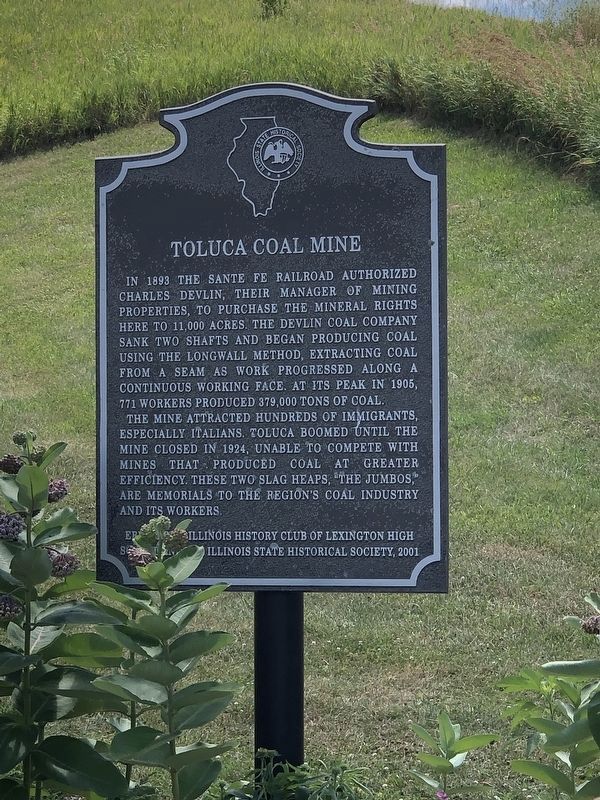
Photographed by Duane and Tracy Marsteller, July 6, 2024
1. Toluca Coal Mine Marker
In 1893 the Sante Fe Railroad authorized Charles Devlin, their manager of mining properties, to purchase the mineral rights here to 11,000 acres. The Devlin Coal Company sank two shafts and began producing coal using the longwall method, extracting coal from a seam as work progressed along a continuous working face. At its peak in 1905, 771 workers produced 379,000 tons of coal.
The mine attracted hundreds of immigrants, especially Italians. Toluca boomed until the mine closed in 1924, unable to compete with mines that produced coal at greater efficiency. These two slag heaps, "The Jumbos," are memorials to the region's coal industry and its workers.
Erected 2001 by Illinoi History Club of Lexington High School and the Illinois State Historical Society.
Topics and series. This historical marker is listed in these topic lists: Industry & Commerce • Railroads & Streetcars. In addition, it is included in the Illinois State Historical Society series list. A significant historical year for this entry is 1893.
Location. 40° 59.973′ N, 89° 8.052′ W. Marker is in Toluca, Illinois, in Marshall County. It is
this page online

Regionally, this marker is in the Illinois River Valley and in Greater Peoria. It is also in the American Midwest and in the Corn Belt. Globally, it is in North America, the Western Hemisphere, the Western World, and the Anglosphere. Historically, it finds itself in what was once the territory of the Mississippian Culture and also the Northwest Territory.
Other nearby markers. At least 7 other markers are within 12 miles of this marker, measured as the crow flies: The Jumbo (a few steps from this marker); Santa Fe Railroad (within shouting distance of this marker); Devlin / Toluca Coal Mine Shaft Number 1 (within shouting distance of this marker); Devlin/Toluca Coal Mine Fan Housing (within shouting distance of this marker); The Pool – A Community Gathering Point (about 400 feet away, measured in a direct line); Site of the first Clear Creek Friends Meeting House (approx. 11½ miles away); John Swaney School (approx. 11½ miles away).
Photographed by Cindi Knox, July 25, 2010
2. Toluca Coal Mine Marker
Photographed by Cindi Knox, July 25, 2010
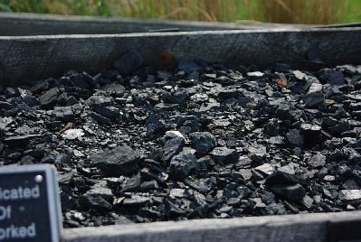
3. Coal Car
Photographed by Cindi Knox, July 25, 2010
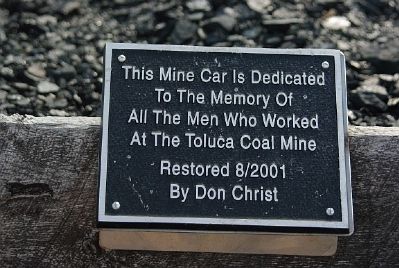
4. Coal Car Plaque
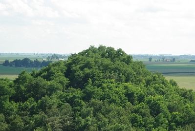
Photographed by Cindi Knox, July 25, 2010
5. View of one jumbo (slag heap) from atop the other
Credits. This page was last revised on August 3, 2024. It was originally submitted on July 27, 2010, by Cindi Knox of Joliet, Illinois. This page has been viewed 2,126 times since then and 66 times this year. Photos: 1. submitted on August 1, 2024, by Duane and Tracy Marsteller of Murfreesboro, Tennessee. 2, 3, 4, 5. submitted on July 27, 2010, by Cindi Knox of Joliet, Illinois. • Craig Swain was the editor who published this page.
