Cullman in Cullman County, Alabama — The American South (East South Central)
Evangelical Protestant Church
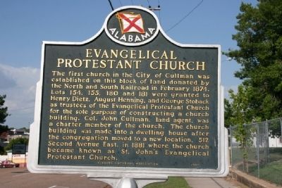
Photographed by Tim Carr, July 31, 2010
1. Evangelical Protestant Church Marker
Topics. This historical marker is listed in these topic lists: Railroads & Streetcars • Religion & Religious Structures • Settlements & Settlers. A significant historical month for this entry is February 1874.
Location. 34° 10.35′ N, 86° 50.767′ W. Marker is in Cullman, Alabama, in Cullman County. It is at the intersection of 4th Street Southwest and 5th Avenue Southwest, on the right when traveling east on 4th Street Southwest. Touch for map. Marker is in this post office area: Cullman AL 35055, United States of America. Touch for directions.

Regionally,
this page online
Other nearby markers. At least 8 other markers are within walking distance of this marker: Weiss Cottage (approx. 0.3 miles away); Sand Mountain Plateau (approx. 0.4 miles away); St. John’s Evangelical Protestant Church (approx. 0.4 miles away); Cullman Railroad Depot (approx. half a mile away); “Die Deutsche Kolonie Von Nord Alabama” (approx. half a mile away); Johann Gottfried Cullmann (approx. half a mile away); Cullman, Alabama (approx. half a mile away); Colonel John G. Cullmann (approx. 0.6 miles away). Touch for a list and map of all markers in Cullman.

Photographed by Tim Carr, July 31, 2010
2. Evangelical Protestant Church Marker
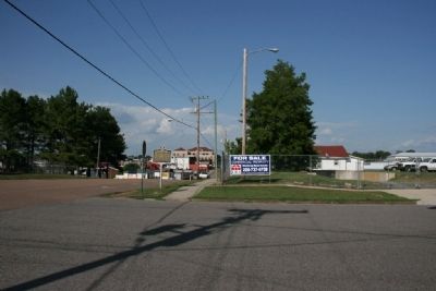
Photographed by Tim Carr, July 31, 2010
3. Evangelical Protestant Church site
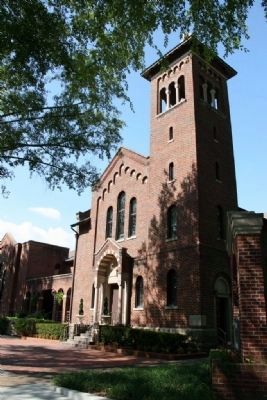
Photographed by Tim Carr, July 31, 2010
4. St. John’s Evangelical Protestant Church
Credits. This page was last revised on October 31, 2019. It was originally submitted on August 1, 2010, by Timothy Carr of Birmingham, Alabama. This page has been viewed 1,689 times since then and 27 times this year. Photos: 1, 2, 3, 4. submitted on August 1, 2010, by Timothy Carr of Birmingham, Alabama. • Syd Whittle was the editor who published this page.
