Near San Andreas in Calaveras County, California — The American West (Pacific Coastal)
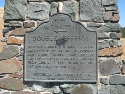
Double Springs
← 2 Miles
Erected by Department of Public Works – Division of Highways. (Marker Number 264.)
Topics and series. This historical marker is listed in this topic list: Notable Places. In addition, it is included in the California Historical Landmarks series list. A significant historical date for this entry is February 18, 1924.
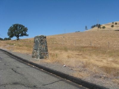
Location. 38° 12.563′ N, 120° 44.518′ W. Marker is near San Andreas, California, in Calaveras County. Marker is on State Highway 12,, 1.3 miles east of State Route 26, on the left when traveling east. The marker is located 5.2 miles east of Valley Springs. Touch for map. Marker is at or near this postal address: 3466 CA-12, Mokelumne Hill CA 95245, United States of America. Touch for directions.
Other nearby markers. At least 8 other markers are within 5 miles of this marker, measured as the crow flies. California Pioneers Reinterred from Poverty Bar Cemetery (approx. 2.1 miles away); Chili Gulch (approx. 2.4 miles away); a different marker also named Double Springs (approx. 2.7 miles away); San Andreas (approx. 3.4 miles away); First Restaurant in Town (approx. 3.4 miles away); Paloma (Fosteria) (approx. 3.6 miles away); Model 1841 12-Pound Field Howitzers (approx. 4.2 miles away); Calaveras County War Memorial (approx. 4.2 miles away). Touch for a list and map of all markers in San Andreas.
More about this marker. A duplicate marker is located 2.7 miles west on Highway 12/26. See "Nearby Marker" Double Springs for additional photos, "Also See" links and additional information.
Credits. This page was last revised on July 3, 2020. It was originally submitted on August 23, 2010, by Syd Whittle of Mesa, Arizona. This page has been viewed 942 times since then and 20 times this year. Last updated on July 3, 2020, by Craig Baker of Sylmar, California. Photos: 1, 2, 3. submitted on August 23, 2010, by Syd Whittle of Mesa, Arizona. • J. Makali Bruton was the editor who published this page.


