Brownsville in Cameron County, Texas — The American South (West South Central)
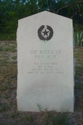
The Battle of Palo Alto
Palo Alto
was fought here
May 8, 1846
and was won by the
Army of the United States
Erected 1936 by the State of Texas. (Marker Number 5289.)
Topics and series. This memorial is listed in this topic list: War, Mexican-American. In addition, it is included in the National Historic Landmarks series list. A significant historical date for this entry is May 8, 1846.
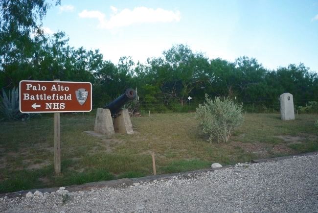
Location. 26° 0.873′ N, 97° 28.861′ W. Marker is in Brownsville, Texas, in Cameron County. Memorial is at the intersection of Farm to Market Road 511 and Arroyo Blvd/Paredes Line Rd (County Route 1847), on the right when traveling west on Road 511. Marker is approx. two miles east of U.S. Hwy 83/77 in a pull off at the southwest corner of the Palo Alto Battlefield National Historic Site. Touch for map. Marker is in this post office area: Brownsville TX 78526, United States of America. Touch for directions.
Other nearby markers. At least 8 other markers are within 4 miles of this marker, measured as the crow flies. Palo Alto Battlefield (a few steps from this marker); Historic Battlefield Trail (a few steps from this marker); a different marker also named Palo Alto Battlefield (approx. 0.2 miles away); Border War / Guerra de fronteras (approx. half a mile away); Chosen Ground / Arena decidida (approx. 0.6 miles away); Cavalry Charge / Se lanzaba la caballería (approx. 0.7 miles away); Three Hundred Supply Wagons / Trescientas carretas de viveres (approx. 0.9 miles away); "Rancho Viejo" (approx. 3.2 miles away). Touch for a list and map of all markers in Brownsville.
Also see . . .
1. National Park Service: Palo Alto Battlefield NHP. (Submitted on September 27, 2010, by Richard E. Miller of Oxon Hill, Maryland.)
2. Battle of Palo Alto. The Battle of Palo Alto was the first major battle of the Mexican-American War and was fought on May 8, 1846, on disputed ground five miles (8 km) from the modern-day city of Brownsville, Texas. A force of some 3,400 Mexican troops (a portion of the Army of The North) led by General Mariano Arista engaged a force of 2,400 United States troops — the so called "US Army of Observation." ... (Submitted on September 27, 2010, by Richard E. Miller of Oxon Hill, Maryland.)
Credits. This page was last revised on January 1, 2021. It was originally submitted on September 27, 2010, by Richard E. Miller of Oxon Hill, Maryland. This page has been viewed 1,483 times since then and 30 times this year. Photos: 1, 2. submitted on September 27, 2010, by Richard E. Miller of Oxon Hill, Maryland. 3. submitted on January 1, 2021, by Craig Doda of Napoleon, Ohio. • Bill Pfingsten was the editor who published this page.


