Gloucester in Essex County, Massachusetts — The American Northeast (New England)
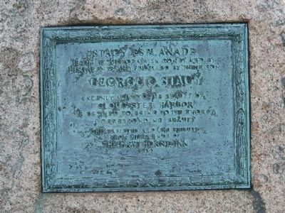
Stacy Esplanade
Is the Result of a Wish Conceived By
His Parents and Fulfilled by Their Son
George O. Stacy
Keenly Alive to the Beauty Of
Gloucester Harbor
He Desired to Bring to Its Shores A
Corresponding Beauty
This Tablet is a Loving Tribute
From His Friends Of
The Hawthorne Inn
1930
Erected 1930.
Topics. This historical marker is listed in this topic list: Charity & Public Work. A significant historical year for this entry is 1930.
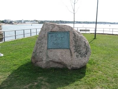
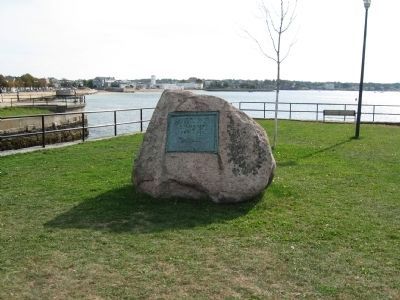
Location. 42° 36.576′ N, 70° 40.387′ W. Marker is in Gloucester, Massachusetts, in Essex County. Marker is at the intersection of Western Avenue (Massachusetts Route 127) and Essex Avenue (Massachusetts Route 133), on the right when traveling north on Western Avenue. Located in Stacy Boulevard Waterfront Park next to the Blynman Bridge and Canal. Touch for map. Marker is in this post office area: Gloucester MA 01930, United States of America. Touch for directions.
Other nearby markers. At least 8 other markers are within walking distance of this marker. Blynman Bridge (within shouting distance of this marker); Gloucester Korean – Vietnam Veterans Monument (within shouting distance of this marker); Gloucester Fishermen's Wives Memorial (about 500 feet away, measured in a direct line); Gloucester Fishermen's Memorial (approx. 0.2 miles away); In Honor of Nathaniel Haraden (approx. 0.2 miles away); Ten Pound Island Lighthouse (approx. 0.2 miles away); Gloucester World War II Monument (approx. 0.2 miles away); Gloucester World War II Merchant Marine Monument (approx. 0.2 miles away). Touch for a list and map of all markers in Gloucester.
Regarding Stacy Esplanade. Prominent builder and hotelier, George O. Stacy was widely known for his many accomplishments in building the tourist trade in East Gloucester. He started the Stacy House, known as the Wedding Cake House and listed in the National Register of Historic Places, in 1897. He also built summer “cottages” on Eastern Point, four of the most celebrated hotels on the North Shore, including the 300-room Colonial Arms (burned in 1908), and later Stacy Boulevard with the famous Fisherman’s Statue.
Credits. This page was last revised on October 8, 2020. It was originally submitted on October 1, 2010, by Michael Herrick of Southbury, Connecticut. This page has been viewed 1,199 times since then and 44 times this year. Photos: 1, 2, 3. submitted on October 1, 2010, by Michael Herrick of Southbury, Connecticut.


