Grants in Cibola County, New Mexico — The American Mountains (Southwest)
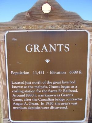
Grants
Population 11,451 Elevation 6500 ft
Topics. This historical marker is listed in these topic lists: Industry & Commerce • Railroads & Streetcars. A significant historical year for this entry is 1880.
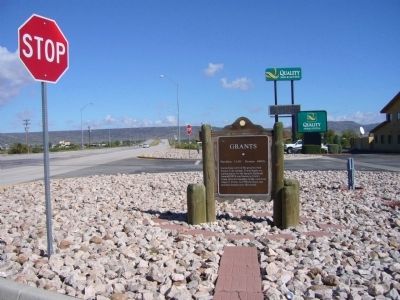
Location. 35° 7.874′ N, 107° 49.624′ W. Marker is in Grants, New Mexico, in Cibola County. Marker is on State Road 117, 0.3 miles north of Interstate 40, on the right when traveling north. Touch for map. Marker is in this post office area: Grants NM 87020, United States of America. Touch for directions.
Other nearby markers. At least 8 other markers are within 3 miles of this marker, measured as the crow flies. The Fannie Mine Hoisting Bucket (approx. 2.2 miles away); Mine Head Frame (approx. 2.2 miles away); One Ton Mine Car (approx. 2.2 miles away); Large Diameter Drill Bit (approx. 2.2 miles away); The Caboose (approx. 2.2 miles away); Vietnam Veterans Memorial (approx. 2.9 miles away); San Rafael (approx. 2.9 miles away); a different marker also named Grants (approx. 2.9 miles away). Touch for a list and map of all markers in Grants.
Credits. This page was last revised on January 6, 2020. It was originally submitted on October 3, 2010, by Bill Kirchner of Tucson, Arizona. This page has been viewed 836 times since then and 19 times this year. Photos: 1, 2, 3. submitted on October 3, 2010, by Bill Kirchner of Tucson, Arizona. 4. submitted on May 12, 2014, by Richard Denney of Austin, Texas. • Syd Whittle was the editor who published this page.


