Phillips Community
Side A
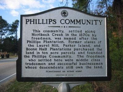
This community, settled along Horlbeck Creek in the 1870s by freedmen, was named after the Phillips Plantation. Former slaves of the Laurel Hill, Parker Island, and Boone Hall Plantations purchased the land in ten acre parcels and founded the Phillips Community. The freedmen who settled here were middle class tradesmen and successful businessmen whose descendants still own the land.
Side B
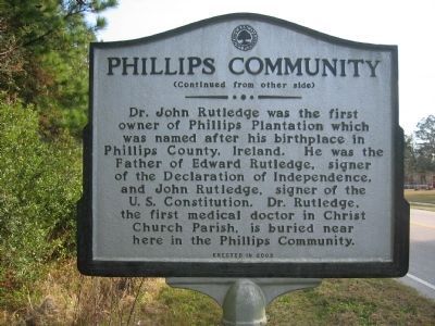
Dr. John Rutledge was the first owner of Phillips Plantation which was named after his birthplace in Phillips County, Ireland. He was the Father of Edward Rutledge, signer of the Declaration of Independence, and John Rutledge, signer of the U.S. Constitution. Dr. Rutledge, the first medical doctor in Christ Church Parish, is buried near here in the Phillips Community.
Erected 2002 by Town of Mount Pleasant.
Topics. This historical marker is listed in these topic lists: African Americans • Patriots & Patriotism.
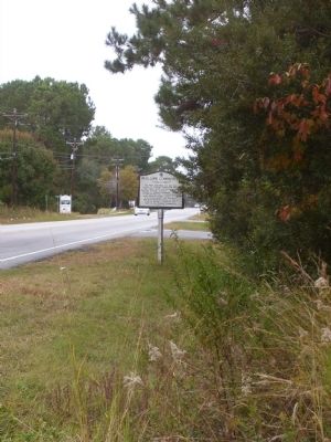
Location. 32° 52.895′ N, 79° 48.591′ W. Marker is in Mount Pleasant, South Carolina, in Charleston County. Marker is at the intersection of State Highway 41 and Joe Rouse Road on State Highway 41. Touch for map. Marker is in this post office area: Mount Pleasant SC 29466, United States of America. Touch for directions.
Other nearby markers. At least 8 other markers are within
Additional commentary.
1. Phillips area not named for an Ireland County.
The marker incorrectly says the Phillips area was named for Dr. John Rutledge’s ancestral home in Phillips County, Ireland. There is no such place. Instead, it was named for Eleazer Phillips and his son, John Milner Phillips, who owned the land in the 1800s, about 100 years after Rutledge did.
Credits. This page was last revised on August 16, 2020. It was originally submitted on November 16, 2010. This page has been viewed 1,719 times since then and 100 times this year. Photos: 1, 2, 3. submitted on November 16, 2010. • Bill Pfingsten was the editor who published this page.


