Marker Logo HMdb.org THE HISTORICAL
MARKER DATABASE
“Bite-Size Bits of Local, National, and Global History”
Hanover in Grant County, New Mexico — The American Mountains (Southwest)
 

Santa Rita Copper Mines


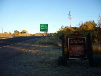
Santa Rita Copper Mines Marker image. Click for full size.
Photographed By Bill Kirchner, November 5, 2010
1. Santa Rita Copper Mines Marker
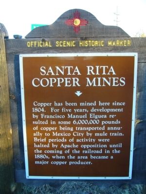
Inscription. Copper has been mined here since 1804. For five years, development by Francisco Manuel Elguea resulted in some 6,000,000 pounds of copper being transported annually to Mexico City by mule train. Brief periods of activity were halted by Apache opposition until the coming of the railroad in the 1880s, when the area became a major copper producer.
 
Topics. This historical marker is listed in this topic list: Industry & Commerce. A significant historical year for this entry is 1804.
 
Location. 32° 46.867′ N, 108° 9.017′ W. Marker is in Hanover, New Mexico, in Grant County. Marker is on U.S. 180 at milepost 120.7, on the right when traveling south. Touch for map. Marker is in this post office area: Hanover NM 88041, United States of America. Touch for directions.
 
Other nearby markers. At least 8 other markers are within 5 miles of this marker, measured as the crow flies. Fort Bayard - 1866-1900 (approx. 0.2 miles away); Fort Bayard (approx. 0.6 miles away); Bayard (approx. 1˝ miles away); Ladies Auxiliary of Local 890 (approx. 2.3 miles away); Kneeling Nun (approx. 2.3 miles away); a different marker also named Bayard (approx. 2.9 miles away); Reclaiming the Land (approx. 4.8 miles away); Modern Mining & Processing (approx. 4.8 miles away). Touch for a list and map of all markers in Hanover.
 
Paid Advertisement
Click on the ad for more information.
Please report objectionable advertising to the Editor.
Click or scan to see
this page online
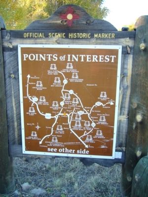
Rear of Santa Rita Copper Mines Marker image. Click for full size.
Photographed By Bill Kirchner, November 5, 2010
2. Rear of Santa Rita Copper Mines Marker
Santa Rita Copper Mines Marker image. Click for full size.
Photographed By Bill Kirchner, November 5, 2010
3. Santa Rita Copper Mines Marker
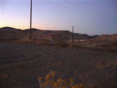
Santa Rita Copper Mines image. Click for full size.
Photographed By Bill Kirchner, November 6, 2010
4. Santa Rita Copper Mines
 
 
Credits. This page was last revised on June 16, 2016. It was originally submitted on November 19, 2010, by Bill Kirchner of Tucson, Arizona. This page has been viewed 1,055 times since then and 38 times this year. Photos:   1, 2, 3, 4. submitted on November 19, 2010, by Bill Kirchner of Tucson, Arizona. • Craig Swain was the editor who published this page.
Share this page.  
Share on Tumblr
m=38216

CeraNet Cloud Computing sponsors the Historical Marker Database.
This website earns income from purchases you make after using our links to Amazon.com. We appreciate your support.
Paid Advertisement
May. 8, 2024