Osprey in Sarasota County, Florida — The American South (South Atlantic)
Osprey School
Inscription.
The Osprey School served the Osprey and Vamo communities from 1927 through June 1976. It was one of four boom-time schools which were designed by Tampa architect M. Leo Elliot and built along the Tamiami Trail between 1926 and 1928.
The land on which the school was built was part of the 145-acre homestead of John and Eliza Webb, originally from Utica, New York, who settled Spanish Point in 1867. Mabel Webb Johnson, granddaughter of John and Eliza Webb, and her husband Ernest recognized that a new school was needed. They sold the plot of land to the school board for $10 0n December 28, 1926.
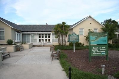
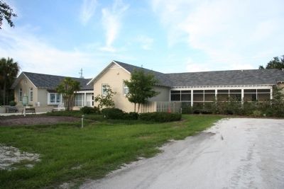
Architect Elliot's plans for the Spanish Colonial Revival-style building recognized the importance of cross-ventilation in a hot and humid climate. Construction of the school was awarded to the firm of Becchetti and Romersa for $19,600. The one-story, six-classroom school initially served grades one through nine.
By the time the school opened in1927, the real estate boom had gone bust and the population of Osprey had declined. With a dwindling tax base, Osprey School and virtually all of the other Sarasota County schools closed for several months in 1933 because of a lack of revenue.
Reverse:
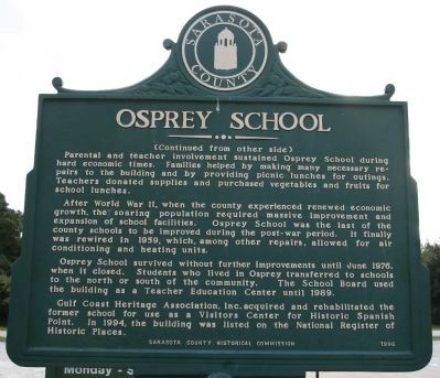
Parental and teacher involvement sustained Osprey School during hard economic times. Families helped by making many necessary repairs to the building and by providing picnic lunches for outings. Teachers donated supplies and purchased vegetables and fruits for school lunches.
After World War II, when the county experienced renewed economic growth, the soaring population required massive improvements and expansion of school facilities. Osprey School was the last of the county schools to be improved during the post-war period. It finally was rewired in 1959, which, among other repairs, allowed for air conditioning and heating units.
Osprey School survived without further improvements until June 1976, when it closed. Students who lived in Osprey transferred to schools to the north or south of the community. The School Board used the building as a Teacher Education Center until 1989.
Gulf Coast Heritage Association, Inc. acquired and rehabilitated the former school for use as a Visitors Center for Historic Spanish Point. In 1994, the building was listed on the National Register of Historic Places.
Erected 1996 by Sarasota County Historical Commission.
Topics. This historical marker is listed in these topic lists: Education • Settlements & Settlers. A significant historical year for this entry is 1927.
Location. 27° 12.078′ N, 82° 29.452′ W. Marker is in Osprey, Florida
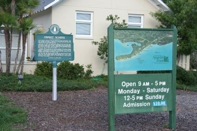
, in Sarasota County. Marker can be reached from the intersection of South Tamiami Trail (U.S. 41) and Spanish Point Road. Although the Osprey School building is located along the South Tamiami Trail, the historical marker is not located in front of the building, rather it is located on the backside of the building, along the walkway from the parking lot to the back entrance of the school building. Touch for map. Marker is in this post office area: Osprey FL 34229, United States of America. Touch for directions.
Other nearby markers. At least 8 other markers are within 6 miles of this marker, measured as the crow flies. Historic Spanish Point (about 300 feet away, measured in a direct line); Palmer Ranch (approx. 2.1 miles away); Oscar Scherer State Park (approx. 2.3 miles away); South Creek Trestle / Oscar Scherer History (approx. 2.7 miles away); Railroad History (approx. 3.4 miles away); Laurel Turpentine Company / Blackburn Sawmill Quarters (approx. 5 miles away); The Edson Keith Estate (approx. 5˝ miles away); Johnson Chapel / Albee Quarters (approx. 5˝ miles away). Touch for a list and map of all markers in Osprey.
Credits. This page was last revised on June 21, 2018. It was originally submitted on November 26, 2010, by Dale K. Benington of Toledo, Ohio. This page has been viewed 867 times since then and 76 times this year. Photos: 1, 2, 3, 4, 5, 6. submitted on November 28, 2010, by Dale K. Benington of Toledo, Ohio.


