Pine Ridge in Lexington County, South Carolina — The American South (South Atlantic)
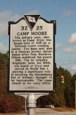
Camp Moore
Erected 1994 by Pine Ridge Woman's Club. (Marker Number 32-25.)
Topics and series. This historical marker is listed in this topic list: Military. In addition, it is included in the Former U.S. Presidents: #28 Woodrow Wilson series list. A significant historical year for this entry is 1913.
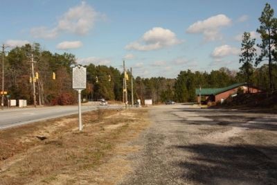
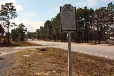
Location. 33° 54.755′ N, 81° 6.178′ W. Marker is in Pine Ridge, South Carolina, in Lexington County. Marker is on Fish Hatchery Road (State Highway 32-73), on the right when traveling north. Located between Pine Ridge Road (State Road 32-103) and Wildlife Lane. Touch for map. Marker is in this post office area: West Columbia SC 29172, United States of America. Touch for directions.
Other nearby markers. At least 8 other markers are within 5 miles of this marker, measured as the crow flies. Congaree Fort (approx. 2.3 miles away); 345th Bombardment Group (approx. 2.8 miles away); Bombardment Groups (approx. 2.8 miles away); 319th Bombardment Group (approx. 2.8 miles away); Columbia Army Air Base / The Doolittle Raiders (approx. 2.8 miles away); Springdale (approx. 3.2 miles away); Congaree Creek Earthworks (approx. 4.3 miles away); Emily Geiger (approx. 4.4 miles away).
Regarding Camp Moore. Hindenburg Line-the war's greatest feat of engineering. More than half a million German workers and Russian POWs toiled for four months building the line; 1, 250 trains hauled materials to construct the steel-reinforced concrete forts and blockhouses. The Hindenburg Line consisted of an elastic defence in-depth: an initial large antitank ditch yielded to a series of at least five barbed-wire barriers; next came a line of defence anchored by forts and blockhouses bristling with machine guns; and the final major barrier boasted an intricate system of zigzag trenches designed to prevent enfilading fire. Two lines of artillery were sited in the rear zone—on reverse slopes wherever possible, and later in trenches and tunnels. In time, the 300 mile (482 km) ‘line’ was extended to consist of five major defensive positions (Flanders, Wotan, Siegfried, Hunding, Kriemhild, and Michel Lines). Ludendorff
judged that the Hindenburg Line freed up ten divisions as well as 50 batteries of heavy artillery, and shortened the front by nearly 30 miles (48 km). But it still required enormous manpower and in 1918, after his final offensives had used up his reserves, he saw his impregnable lines breached by the resurgent Allies.
Also see . . . Teaching American History in South Carolina Project. As the United States entered World War I in 1917, troops began to train and deploy from newly constructed camps or bases. The two camps mentioned in the images are of Camp Jackson (now Fort Jackson), which opened on September 1, 1917, and Camp Moore, (now the Pine Ridge National Guard Armory). South Carolina was an ideal location for military training facilities, due to the warm climate and cheap labor. The opening of new camps and expansion of old bases brought new jobs and economic growth to the state that would continue to anchor the state’s economy throughout the twentieth century. (Submitted on December 18, 2010, by Mike Stroud of Bluffton, South Carolina.)
Credits. This page was last revised on June 16, 2016. It was originally submitted on December 18, 2010, by Mike Stroud of Bluffton, South Carolina. This page has been viewed 1,395 times since then and 54 times this year. Photos: 1, 2, 3. submitted on December 18, 2010, by Mike Stroud of Bluffton, South Carolina.


