Brandywine in Prince George's County, Maryland — The American Northeast (Mid-Atlantic)
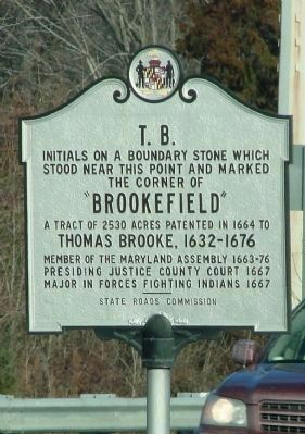
T. B.
Photographed by Jacqui Chalifoux, July 11, 2010
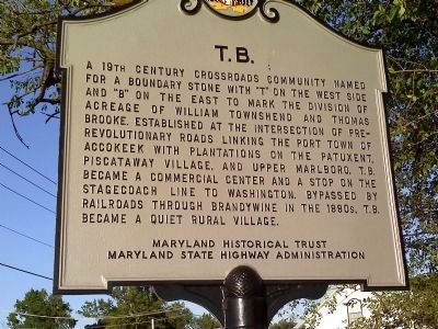
1. T.B. Marker
Erected 2009 by Maryland Historical Trust, Maryland State Highway Administration.
Topics and series. This historical marker is listed in these topic lists: Agriculture • Settlements & Settlers. In addition, it is included in the Maryland Historical Trust series list.
Location. 38° 42.078′ N, 76° 52.463′ W. Marker is in Brandywine, Maryland, in Prince George's County. It is at the intersection of Branch Avenue (Maryland Route 5) and Accokeek Road ( Route 373), in the median on Branch Avenue. Touch for map. Marker is at or near this postal address:
this page online

Regionally, this marker is in the Washington Metropolitan Area. It is also in the American South, specifically in the Upper South, in the Mid-Atlantic, and on the Eastern Seaboard. Globally, it is in the North Atlantic Region, North America, the Western Hemisphere, the Western World, and the Anglosphere. Historically, it finds itself in what was once one of the original Thirteen Colonies and also the Antebellum South.
Other nearby markers. At least 8 other markers are within 4 miles of this marker, measured as the crow flies: John Wilkes Booth and his companion David Herold (approx. 2.6 miles away); Thrift School (approx. 3.1 miles away); Purple Heart Memorial (approx. 3.2 miles away); Veterans Memorial Display (approx. 3.2 miles away); Louise F. Cosca Regional Park (approx. 3.2 miles away); Louis Sheir Memorial (approx. 3.2 miles away); House of Reformation (approx. 3½ miles away); Church of the Atonement, 1875 (approx. 3½ miles away). Touch for a list and map of all markers in Brandywine.
Other markers no longer nearby. T. B.
Photographed by Jacqui Chalifoux, November 15, 2010
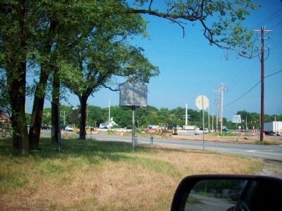
2. T.B. Marker Facing Rt. 5 (Branch Ave) and 373 (Accokeek Rd)
Regarding T. B.. “T.B.” was the name of a 19th century village that stood at the intersection of present-day Brandywine Road and Old Brandywine Road. The village's name reportedly derives from the boundary stone that marked the division between lands owned by William Townshend and Thomas Brooke. The marker had a "T" on one side and a "B" on the other.
Photographed by Jacqui Chalifoux, July 15, 2010
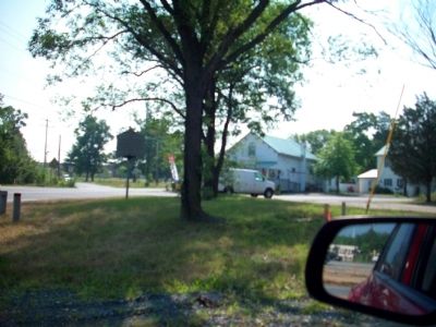
3. T.B. Marker Facing Brandywine Rd
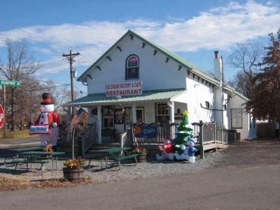
The Marlow-Huntt house, which was recently an ice cream store, is now an Indian cuisine restaurant.
Photographed by F. Robby, November 29, 2007
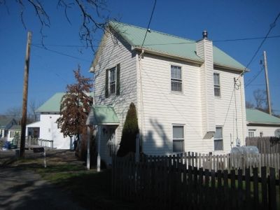
4. 13702 Old Brandywine Road
This building is the former Casket Shop built in 1878 and located next to the Marlow-Huntt Store in the background, orginally all part of the same tax property. The two buildings are the last remnants of the village of T.B.
Photographed by F. Robby, November 29, 2007
5. 13700 Old Brandywine Road
This building is the former Marlow-Huntt Store built in 1867 and located at the intersection of Brandywine Road and Old Brandywine Road, about 500 feet west of the T.B. marker. It was used at the turn of the century as a general store and post office for the rural community of T.B. Restored by its current owners, the building now houses the Ice Cream Factory and Cafe. The building is registered as a Prince George's County Historic Site.
Photographed by Richard White, February 9, 2007
6. The original T.B. Marker near this site
Initials on a boundary stone which stood near this point and marked the corner of “Brookefield” a tract of 2530 acres patented in 1664 to Thomas Brooke, 1632–1676, member of the Maryland Assembly 1633–76,
Presiding Justice County Court 1667,
Major in forces fighting Indians 1667.
Click for more information.
Click for more information.
Credits. This page was last revised on April 2, 2025. It was originally submitted on July 16, 2010, by Jacqueline White of Williamsburg, VA - Virginia. This page has been viewed 5,269 times since then and 163 times this year. Last updated on January 7, 2011. Photos: 1. submitted on July 11, 2010, by Jacqueline White of Williamsburg, VA - Virginia. 2, 3. submitted on July 15, 2010, by Jacqueline White of Williamsburg, VA - Virginia. 4, 5. submitted on November 29, 2007, by F. Robby of Baltimore, Maryland. 6. submitted on April 8, 2007, by Richard White of La Plata, Maryland. • Bill Pfingsten was the editor who published this page.
