Near Bison in Garfield County, Oklahoma — The American South (West South Central)
Buffalo Springs
On the Old Chisholm Trail. 1/3 mi West
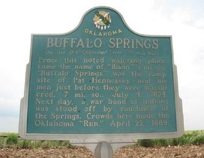
1. Buffalo Springs Marker
Erected by Oklahoma Historical Society and State Highway Commission.
Topics and series. This historical marker is listed in this topic list: Notable Places. In addition, it is included in the Oklahoma Historical Society series list. A significant historical month for this entry is April 1974.
Location. 36° 12.898′ N, 97° 53.237′ W. Marker is near Bison, Oklahoma, in Garfield County. It is on U.S. 81 ¼ mile south of County Road E0550, on the right when traveling south. Touch for map. Marker is in this post office area: Bison OK 73720, United States of America. Touch for directions.

Regionally, this marker is in Northwest Oklahoma — Red Carpet Country and specifically in Central Oklahoma—Frontier Country. It is also in the American South, specifically on the prairies, and on the Southern Plains. Globally,
this page online
Other nearby markers. At least 8 other markers are within 8 miles of this marker, measured as the crow flies: Cherokee Strip (approx. 3½ miles away); Run of '89 North Boundary (approx. 3½ miles away); Massacre of Pat Hennessey (approx. 7.2 miles away); Lest We Forget (approx. 7.2 miles away); Roy V. Cashion (approx. 7.2 miles away); Tribute to Patriotism and Valor (approx. 7.2 miles away); Pat Hennessey (approx. 7.2 miles away); First Rural Mail Route (approx. 7.2 miles away). Touch for a list and map of all markers in Bison.
Regarding Buffalo Springs. The town of Hennessey, OK, located 7 miles to the south of this marker, is named after Pat Hennessey.
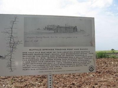
2. Buffalo Springs Marker
One half mile due west of this location stood Buffalo Springs trading post, ranch, and stagecoach stand. This sketch of the ranch was made by Adolph Hunnius, a surveyor, in 1876. Buffalo Springs was a well-used stop for drovers and herds along this western trail variant. It was from this location that the ill-fated Hennessey Party departed on July 4, 1874, headed south along the Ft. Sill-Arkansas City wagon road despite warning of Indian hostilities in the area. A few miles south, the Party was attacked and killed.
Credits. This page was last revised on June 16, 2016. It was originally submitted on January 19, 2011, by Christopher Suttle of Norman, Oklahoma. This page has been viewed 1,598 times since then and 87 times this year. Photos: 1, 2. submitted on January 19, 2011, by Christopher Suttle of Norman, Oklahoma. • Bill Pfingsten was the editor who published this page.
Editor’s want-list for this marker. A photo of the marker and the surrounding area in context. • Can you help?
