Tarversville in Twiggs County, Georgia — The American South (South Atlantic)
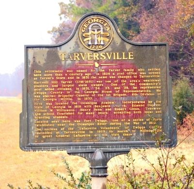
Tarversville
Hartwell Hill Tarver (1791-1851) was one of the area’s wealthiest planters and largest slave owners. One of the community’s most noted citizens, in 1831, ‘34, ‘35, and ‘39, he represented Twiggs County in the Georgia House of Representatives. He was elected Brigadier-General of the 1st Brigade, 6th Division of the Georgia Militia, in 1837.
Here was located the Ocmulgee Academy, incorporated by the State of Georgia in 1819 with Benjamin Dupree, Edmund Dupree, William W. Williamson, Henry Bunn and Robert Glenn, Trustees. The school flourished for many years, accepting both local and boarding students.
Located near here was Fort Twiggs, one of a series of forts established near the Ocmulgee River during the War of 1812.
The nucleus of the “Lafayette Volunteers” of Twiggs County assembled at Tarversville in 1825 to march to Milledgeville to greet General Lafayette on his visit there.
Erected 1960 by Georgia Historical Commission. (Marker Number 143-10.)
Topics and series. This historical marker is listed in these topic lists: Education • Forts and Castles • Settlements & Settlers • War of 1812. In addition, it is included in the Georgia Historical Society series list. A significant historical year for this entry is 1826.
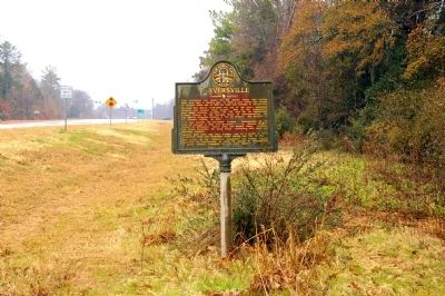
Location. 32° 32.409′ N, 83° 26.414′ W. Marker is in Tarversville, Georgia, in Twiggs County. Marker is on Golden Isles Highway (U.S. 23) 0.1 miles south of Georgia Route 96, on the left when traveling south. Touch for map. Marker is in this post office area: Jeffersonville GA 31044, United States of America. Touch for directions.
Other nearby markers. At least 8 other markers are within 10 miles of this marker, measured as the crow flies. Longstreet Methodist Church (approx. 5˝ miles away); Richland Baptist Church (approx. 6.7 miles away); Evergreen Baptist Church (approx. 6.9 miles away); Arthur Fort, 1750-1833 (approx. 7 miles away); Geographic Center of Georgia (approx. 8.4 miles away); POW/MIA Memorial (approx. 9.3 miles away); 19th Air Refueling Wing Monument (approx. 9.3 miles away); The Medal of Honor (approx. 9.3 miles away).
Credits. This page was last revised on June 16, 2016. It was originally submitted on January 31, 2011, by David Seibert of Sandy Springs, Georgia. This page has been viewed 1,580 times since then and 102 times this year. Photos: 1, 2. submitted on January 31, 2011, by David Seibert of Sandy Springs, Georgia. • Bernard Fisher was the editor who published this page.

