Gays Mills in Crawford County, Wisconsin — The American Midwest (Great Lakes)
Gays Mills Sesquicentennial
1848 – 1998
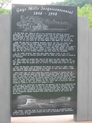
Here Mr. Gay built a lucrative business, sawing the pine logs from the La Farge – Ontario region that were rafted down the Kickapoo, and the hardwood logs cut from the nearby hills into the rough lumber then used in the construction of houses and barns. It didn't take long before the sawmill was not only producing rough lumber of every kind, but producing shingles and lath as well. Its finished product was piled along the riverbank.
In the years between 1848 and 1860 many families came to the little community, which by mutual consent bore the name of Gay's Mills in honor of it's founders.
In 1865 George M. Wilbur and John M. Gay built the first flour mill. The mill was a one and a half story structure about thirty by forty feet in size. Two years later Mr. Wilber sold his interest to Richard Only, a son-in-law of Mr. Gay.
Later the building was remodeled and raised to a height of three stories. The mill was taken over by Thomas W. Gay (son of John Gay), Samuel H. Robb and James A. Robb who operated it until 1888.
Since Gay's was the only flour mill within a distance of twenty-five or thirty miles, farmers from as far away as Eastman came here to mill and it was not unusual to see thirty or forty teams standing in line waiting for their owners turn to have the wheat ground into the winters supply of flour. During the fall and winter months the mill operated on two twelve hour shifts in order to meet the demand. The mill noted for its excellence had an operation capacity of seventy-five barrels a day.
The flour mill continued to dominate the business life of the community. The Gay and Robb families sold the mill to the King Haggerty Company and the new owners again enlarged the mill with an addition over the road. The mill continued in the ownership of Atwood Haggerty until 1924. It was then sold to the Interstate Power Company and later turned over to the Village of Gays Mills.
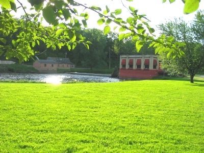
The hydro – electric plant at Gays Mills was owned by Interstate Power Company and later Wisconsin Power and Light Co. Ownership was transferred to the village in 1960.
Erected 1998.
Topics. This historical marker is listed in this topic list: Settlements & Settlers. A significant historical year for this entry is 1847.
Location. 43° 19.127′ N, 90° 51.009′ W. Marker is in Gays Mills, Wisconsin, in Crawford County. Marker is at the intersection of Main Street (State Highway 171) and West Orin Street on Main Street. Touch for map. Marker is in this post office area: Gays Mills WI 54631, United States of America. Touch for directions.
Other nearby markers. At least 8 other markers are within 14 miles of this marker, measured as the crow flies. Cliff Swallows (within shouting distance of this marker); Gays Mills Apple Orchards (approx. half a mile away); Beauford T. Anderson (approx. 5˝ miles away); James Davidson (approx. 6.4 miles away); Soldiers Grove Origin (approx. 6˝ miles away); Black Hawk Trail (approx. 8.8 miles away); John McCulloch (approx. 12 miles away); Trade Links – River Borne (approx. 13˝ miles away). Touch for a list and map of all markers in Gays Mills.
Also see . . . History of Gays Mills. (Submitted on February 3, 2011.)
Credits. This page was last revised on June 16, 2016. It was originally submitted on February 3, 2011, by Keith L of Wisconsin Rapids, Wisconsin. This page has been viewed 893 times since then and 17 times this year. Photos: 1, 2, 3, 4, 5, 6. submitted on February 3, 2011, by Keith L of Wisconsin Rapids, Wisconsin.


