Antioch in Prince William County, Virginia — The American South (Mid-Atlantic)
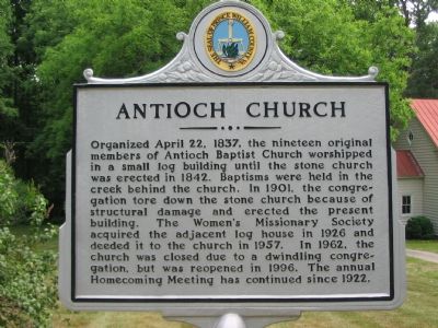
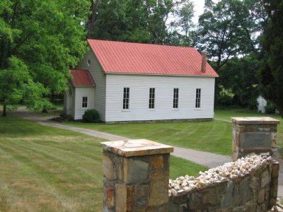
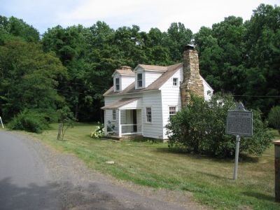
Antioch Church
Erected 2002 by Prince William County Historical Commission.
Topics and series. This historical marker is listed in these topic lists: Churches & Religion • Notable Buildings. In addition, it is included in the Virginia, Prince William County Historical Commission series list. A significant historical date for this entry is April 22, 1863.
Location. 38° 51.465′ N, 77° 41.057′ W. Marker is in Antioch, Virginia, in Prince William County. Marker is on Waterfall Road (Virginia Route 601), on the right when traveling east. Touch for map. Marker is in this post office area: Haymarket VA 20169, United States of America. Touch for directions.
Other nearby markers. At least 8 other markers are within 3 miles of this marker, measured as the crow flies. Hopewell Gap (within shouting distance of this marker); The Carolina Road (approx. 2.6 miles away); Bull Run Mountains Natural Area Preserve (approx. 2.6 miles away); Chapman's Mill (approx. 2.6 miles away); Free People Of Color At Thoroughfare (approx. 2.6 miles away); Thoroughfare Gap (approx. 2.8 miles away); a different marker also named Thoroughfare Gap (approx. 2.8 miles away); Campaign of Second Manassas (approx. 2.8 miles away).
Also see . . . History of Antioch Baptist Church. (Submitted on September 27, 2008.)
Credits. This page was last revised on June 16, 2016. It was originally submitted on June 29, 2007, by Craig Swain of Leesburg, Virginia. This page has been viewed 2,595 times since then and 35 times this year. Last updated on February 5, 2011. Photos: 1, 2, 3. submitted on June 29, 2007, by Craig Swain of Leesburg, Virginia. • Kevin W. was the editor who published this page.


