Aynor in Horry County, South Carolina — The American South (South Atlantic)
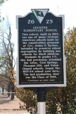
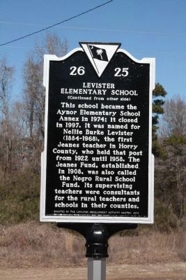
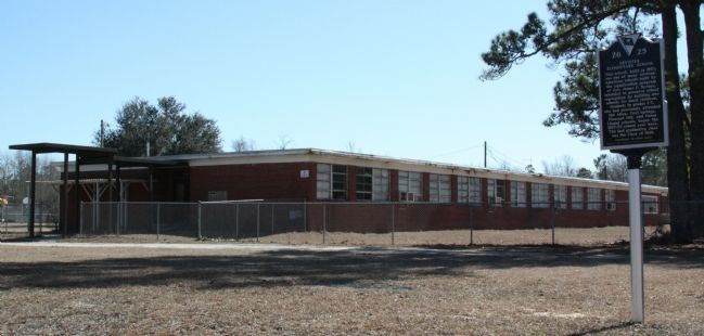
Levister Elementary School
This school became the Aynor Elementary School Annex in 1974; it closed in 1997. It was named for Nellie Burke Levister (1884–1968), the first Jeanes teacher in Horry County, who held that post from 1922 until 1958. The Jeanes Fund, established in 1908, was also called the Negro Rural School Fund. Its supervising teachers were consultants for the rural teachers and schools in their counties.
Erected 2010 by the Levister Development Activity Center. (Marker Number 26-25.)
Topics. This historical marker is listed in these topic lists: African Americans • Education. A significant historical year for this entry is 1953.
Location. 33° 59.6′ N, 79° 11.867′ W. Marker is in Aynor, South Carolina, in Horry County. Marker is at the intersection of 11th Avenue and Gum Street on 11th Avenue. Touch for map. Marker is at or near this postal address: 100 11th Ave, Aynor SC 29511, United States of America. Touch for directions.
Other nearby markers. At least 8 other markers are within 11 miles of this marker, measured as the crow flies. Galivants Ferry (approx. 5.1 miles away); Holliday Highway (approx. 5.1 miles away); Galivants Ferry Stump Meeting (approx. 5.1 miles away); Raising Tobacco (approx. 10˝ miles away); Making the Cut (approx. 10˝ miles away); Taking Stock of Animals on the Farm (approx. 10˝ miles away); Working Iron (approx. 10˝ miles away); Wood to Wagon (approx. 10˝ miles away).
Additional commentary.
1.
I went to school there from 1st thru 7th grade. I'd love to get the names of the teachers. I went there 1961 thru 1968. I remember the McQueen sisters and Mr Best taught 6th grade. Wonderful time in my life.
— Submitted December 16, 2016, by Julius Gore of Lake Hiawatha, New Jersey.
2.
I attended this school in 1966 or 1967. The principal was Rev McClary, and his wife Mrs. McClary alone with teachers McQueen, Best. I would like to know if there are any pictures of rev McClary his wife as well as the other teachers. I want to share with my children.
— Submitted December 30, 2023, by Priscilla Gerald Hamilton of Miami, Florida.
Credits. This page was last revised on March 9, 2024. It was originally submitted on February 13, 2011, by J. J. Prats of Powell, Ohio. This page has been viewed 1,602 times since then and 55 times this year. It was the Marker of the Week February 20, 2011. Photos: 1, 2, 3. submitted on February 13, 2011, by J. J. Prats of Powell, Ohio.


