San Diego in San Diego County, California — The American West (Pacific Coastal)
Mule Hill
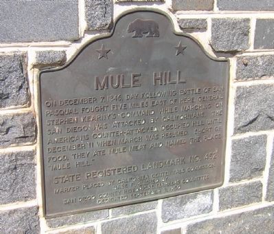
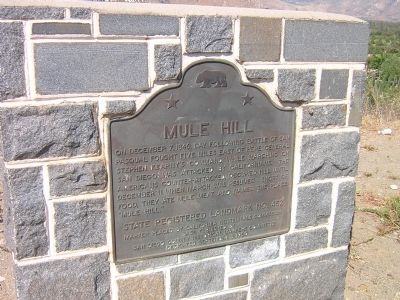
On December 7, 1846, day following Battle of San Pasqual fought five miles east of here, General Stephen Kearny’s command while marching on San Diego was attacked by Californians. The Americans counter-attacked, occupied hill until December 11 when march was resumed. Short of food, they ate mule meat and named the place “Mule Hill.”
Erected 1950 by California Centennials Commission. (Marker Number 452.)
Topics and series. This historical marker is listed in this topic list: War, Mexican-American. In addition, it is included in the California Historical Landmarks series list. A significant historical month for this entry is December 1835.
Location. 33° 3.308′ N, 117° 4.169′ W. Marker is in San Diego, California, in San Diego County. Marker is on Pomerado Road near Interstate 15, on the right when traveling west. Located just before the north-bound on-ramp to I-15. Touch for map. Marker is at or near this postal address: 20397 Palmarado Road, San Diego CA 92128, United States of America. Touch for directions.
Other nearby markers. At least 8 other markers are within 7 miles of this marker, measured as the crow flies. Veterans Memorial (approx. 2.6 miles away); San Pasqual Battlefield (approx. 5.1 miles away); San Pasqual (approx. 5.1 miles away); An Incident of the Mexican War (approx. 5˝ miles away); DJ Ranch Formerly: Kent Farm (approx. 5.9 miles away); Dearborn Memorial Park (approx. 6.1 miles away); Baldwin Locomotive No. 3 (approx. 6.1 miles away); Porter House (approx. 6.1 miles away).
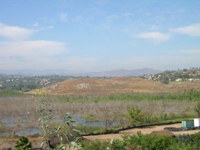
More about this marker. Standing at the marker, facing north, you will see the North County Fair Shopping Mall. Towards your right (eastward) you will see Mule Hill, but the hill itself is not marked.
Regarding Mule Hill. The Battlefield at San Pasqual and interpretive museum are about five or six miles away. See "Nearby Marker" An Incident of the Mexican War for additional information.
Also see . . . Ghosts of Mule Hill. GeoCalifornia website entry (Submitted on June 12, 2021, by Larry Gertner of New York, New York.)
Additional keywords. Battle of San Pasqual, General Stephen Kearny
Credits. This page was last revised on June 12, 2021. It was originally submitted on March 12, 2011, by T. Elizabeth Renich of Winchester, Virginia. This page has been viewed 1,923 times since then and 76 times this year. Photos: 1, 2, 3. submitted on March 12, 2011, by T. Elizabeth Renich of Winchester, Virginia. • Syd Whittle was the editor who published this page.


