Louisburg in Franklin County, North Carolina — The American South (South Atlantic)
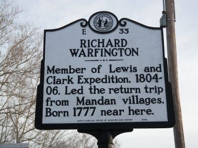
Richard Warfington
Erected 2009 by North Carolina Office of Archives and History. (Marker Number E-33.)
Topics and series. This historical marker is listed in this topic list: Exploration. In addition, it is included in the Lewis & Clark Expedition, and the North Carolina Division of Archives and History series lists. A significant historical year for this entry is 1777.
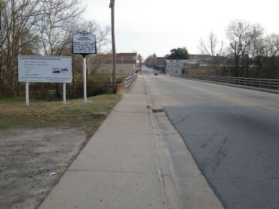
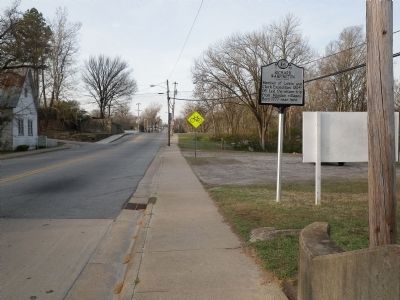
Location. 36° 5.833′ N, 78° 18.142′ W. Marker is in Louisburg, North Carolina, in Franklin County. Marker is on South Main Street north of Seaboard Street, on the right when traveling south. Touch for map. Marker is at or near this postal address: 501 S Main St, Louisburg NC 27549, United States of America. Touch for directions.
Other nearby markers. At least 8 other markers are within 9 miles of this marker, measured as the crow flies. John Williamson (approx. 0.3 miles away); Green Hill Place (approx. 0.4 miles away); Edwin Wiley Fuller (approx. half a mile away); Louisburg College (approx. 0.6 miles away); Camp Site for Sherman's Army (approx. 0.6 miles away); Franklin Male Academy Building (approx. 0.6 miles away); Thomas W. Bickett (approx. one mile away); Moses A. Hopkins (approx. 8.8 miles away). Touch for a list and map of all markers in Louisburg.
Also see . . .
1. Richard Warfington.
On 4 August 1804, the captains were in a quandary as the keeled boat and pirogues traveled between future Nebraska and Iowa. They were well downriver from the Mandan–Hidatsa villages, from which they intended to dispatch the keelboat back to St. Louis that summer or fall of 1804. The man they had assigned to lead the return party back to St. Louis, Cpl. Richard Warfington, had joined the army five years ago and his hitch was up this day. He could choose to leave the service, and hitch downriver with the next passing flotilla of fur traders. Happily, Warfington agreed to stay on, which turned out to mean spending the long, cold winter at Fort Mandan.(Submitted on February 7, 2023, by Michael Buckner of Durham, North Carolina.)
2. Corporal Richard Warfington.
Richard Warfington was born in the area of Louisburg, North Carolina in 1777 and he joined the U.S. Army in 1799. His enlistment information stated he was five feet ten inches tall, had brown hair and black eyes, with a fair complexion. He transferred to the Corps of Discovery from Captain John Campbell’s company of the 2nd Infantry Regiment in November 1803, with the rank of corporal.(Submitted on February 7, 2023, by Michael Buckner of Durham, North Carolina.)
Credits. This page was last revised on February 8, 2023. It was originally submitted on March 25, 2011, by John Zadrozny of Youngsville, North Carolina. This page has been viewed 857 times since then and 44 times this year. Last updated on February 7, 2023, by Michael Buckner of Durham, North Carolina. Photos: 1, 2, 3. submitted on March 25, 2011, by John Zadrozny of Youngsville, North Carolina. • Bernard Fisher was the editor who published this page.


