Christiansburg in Montgomery County, Virginia — The American South (Mid-Atlantic)
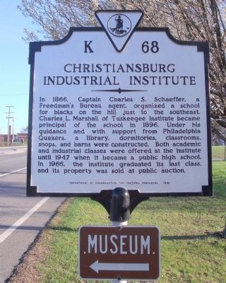
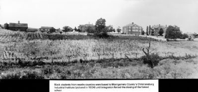
Christiansburg Industrial Institute
Erected 1988 by Department of Conservation and Historic Resources. (Marker Number K-68.)
Topics and series. This historical marker is listed in these topic lists: African Americans • Churches & Religion • Education. In addition, it is included in the Quakerism, and the Virginia Department of Historic Resources (DHR) series lists. A significant historical year for this entry is 1866.
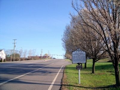
Location. 37° 8.562′ N, 80° 24.896′ W. Marker is in Christiansburg, Virginia, in Montgomery County. Marker is at the intersection of North Franklin Street (Business U.S. 460) and Scattergood Drive NE, on the right when traveling north on North Franklin Street. Touch for map. Marker is in this post office area: Christiansburg VA 24073, United States of America. Touch for directions.
Other nearby markers. At least 8 other markers are within walking distance of this marker. Christiansburg Institute (about 300 feet away, measured in a direct line); The Oaks (approx. 0.9 miles away); Slavery (approx. 0.9 miles away); Education (approx. 0.9 miles away); Community Life (approx. 0.9 miles away); Montgomery County Confederate Monument (approx. 0.9 miles away); Confederate Christiansburg (approx. 0.9 miles away); Lewis-McHenry Duel (approx. one mile away). Touch for a list and map of all markers in Christiansburg.
Also see . . .
1. Christiansburg Institute. (Submitted on April 4, 2011.)
2. Christiansburg Institute. Montgomery Museum of Art & History (Submitted on November 10, 2021.)
3. Christiansburg Institute. Wikipedia (Submitted on November 10, 2021.)
Credits. This page was last revised on November 10, 2021. It was originally submitted on April 4, 2011, by Bernard Fisher of Richmond, Virginia. This page has been viewed 1,002 times since then and 30 times this year. Photos: 1, 2. submitted on April 4, 2011, by Bernard Fisher of Richmond, Virginia. 3. submitted on April 4, 2011.


