Boca Raton in Palm Beach County, Florida — The American South (South Atlantic)
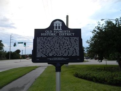
Old Floresta Historic District
In October 1925, architect Addison Mizner announced construction of houses for his company’s executives and his brother, the Reverend Henry Mizner, in the subdivision now known as Old Floresta. The Robinson Company, a New York contractor building the Cloister Inn in Boca Raton, won the contract for 29 Mizner-designed houses. With the end of the real estate boom in 1926, the Mizner Development Corporation collapsed before Robinson could complete the houses. The Chicago partners, headed by Hermann V. von Holst, from whom Mizner purchased the land for Old Floresta, held the mortgage and filed for foreclosure. Von Holst then supervised the completion of the unfinished houses, proposed new names for the streets, and suggested calling the subdivision Floresta, “a delightful rural place” in Spanish. Since the 1920s, Old Floresta, with its Spanish-style architecture of rough-finished stucco walls, wrought iron balconies, and barrel tile roofs, combined with the subdivision’s narrow tree-lined streets and lush landscaping, has remained one of Boca Raton’s most distinctive neighborhoods. In 1990, Old Floresta became Boca Raton’s first historic district.
Erected 2008 by The Boca Raton Historical Society and the Florida Department of State. (Marker Number F-635.)
Topics. This historical marker is listed in this topic list: Notable Places. A significant historical month for this entry is October 1925.
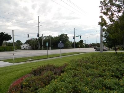
Location. 26° 21.03′ N, 80° 6.266′ W. Marker is in Boca Raton, Florida, in Palm Beach County. Marker is at the intersection of West Palmetto Park Road (County Road 798) and Cardinal Avenue, on the right when traveling west on West Palmetto Park Road. Touch for map. Marker is in this post office area: Boca Raton FL 33486, United States of America. Touch for directions.
Other nearby markers. At least 8 other markers are within 3 miles of this marker, measured as the crow flies. F.E.C. Railway Depot, Boca Raton (approx. 1.1 miles away); Boca Raton Town Hall (approx. 1.1 miles away); Sanborn Square (approx. 1.1 miles away); Boca Raton Army Air Field B-34 Crash (approx. 1.7 miles away); The Sanborn Wall (approx. 2.1 miles away); First Zion Missionary Baptist Church (approx. 2.3 miles away); Branhilda Richardson Knowles Memorial Park and Historic Cemetery (approx. 2.7 miles away); The Barefoot Mailmen (approx. 3 miles away). Touch for a list and map of all markers in Boca Raton.
Also see . . . Boca Raton's History. Boca Raton Historical Society website entry (Submitted on April 14, 2011, by Bernard Fisher of Richmond, Virginia.)
Credits. This page was last revised on June 30, 2022. It was originally submitted on April 13, 2011, by Judith Barber of Marietta, Georgia. This page has been viewed 1,714 times since then and 162 times this year. Photos: 1, 2. submitted on April 13, 2011, by Judith Barber of Marietta, Georgia. • Bernard Fisher was the editor who published this page.

