Ridgeville in Dorchester County, South Carolina — The American South (South Atlantic)
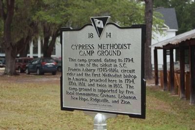
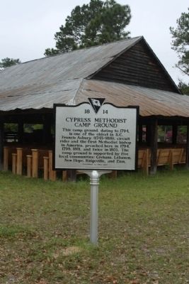
Cypress Methodist Camp Ground
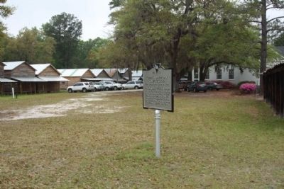
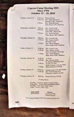
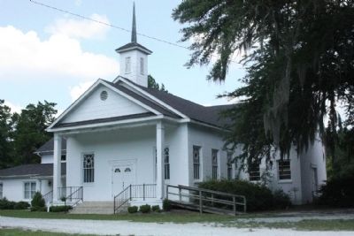
This camp ground, dating to 1794, is one of the oldest in S.C. Francis Asbury (1745-1816), circuit rider and the first Methodist bishop in America, preached here in 1794, 1799, 1801, and twice in 1803. The camp ground is supported by five local communities: Givhans, Lebanon, New Hope, Ridgeville, and Zion.
(Reverse text)
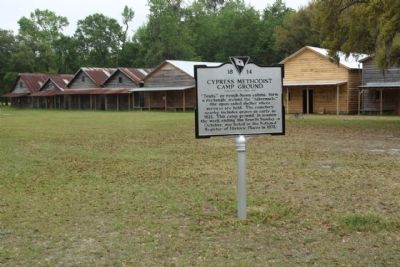
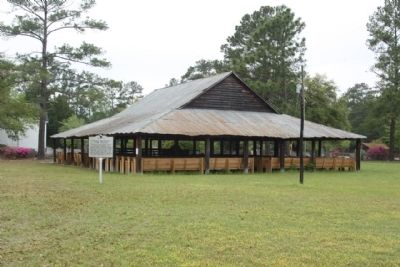
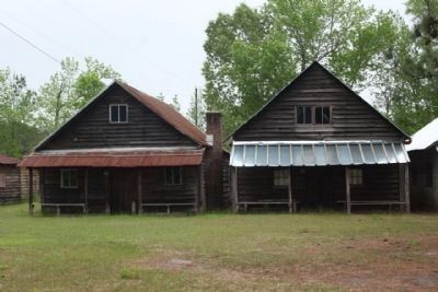
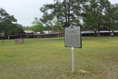
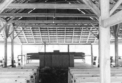
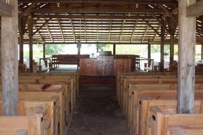
“Tents,” or rough-hewn cabins, form a rectangle around the “tabernacle,” the open-sided shelter where services are held. The cemetery nearby includes graves as early as 1821. This camp ground, in session the week ending the fourth Sunday in October, was listed in the National Register of Historic Places in 1978.
Erected 2009 by The Upper Dorchester County Historical Society. (Marker Number 18-14.)
Topics and series. This historical marker is listed in this topic list: Churches & Religion. In addition, it is included in the Francis Asbury, Traveling Methodist Preacher series list. A significant historical year for this entry is 1794.
Location. 33° 6.204′ N, 80° 16.397′ W. Marker is in Ridgeville, South Carolina, in Dorchester County. Marker is on Cypress Campground Road near Myers Mayo Road (South Carolina Highway 18-182). Located at the Center of the Campground, between U.S. Hwy. 78 and I-26. Touch for map. Marker is in this post office area: Ridgeville SC 29472, United States of America. Touch for directions.
Other nearby markers. At least 8 other markers are within 8 miles of this marker, measured as the crow flies. Ridgeville (approx. 2˝ miles away); Berkeley County (approx. 3.1 miles away); Moorefield Memorial Highway, (Southern Terminus) (approx. 5.2 miles away); Revolutionary War Cannon (approx. 5.3 miles away); Four Holes Swamp (approx. 5.3 miles away); Four Holes Swamp Bridge / Harley's Tavern (approx. 5.3 miles away); Wassamassaw (approx. 7.2 miles away); Dorchester (approx. 7˝ miles away). Touch for a list and map of all markers in Ridgeville.
Regarding Cypress Methodist Camp Ground. Cypress Methodist Camp Ground is one of only a few campgrounds in South Carolina which, up until the time of its nomination, continues to host annual week-long camp meetings—a vestige of the Great Awakening in American religious life in the nineteenth century. Cypress is significant for its association with Francis Asbury, pioneer of American Methodism, and for its long, uninterrupted use as a site of revivalism for almost 200 years. The campground is in the general shape of a rectangle of 34 tents, or cabins, made of rough-hewn lumber. These cabins, rectangular shaped, are generally 1½ stories and contain earthen floors. The typical floor
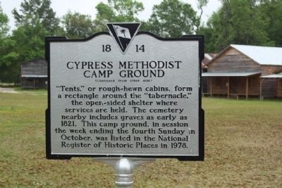
Photographed By Mike Stroud, April 10, 2011
2. Cypress Methodist Camp Ground Marker, reverse side
National Register of Historic Places:
Cypress Methodist Camp Ground ** (added 1978 - - #78002504)
Historic Significance: Architecture/Engineering, Person • Architect, builder, or engineer: Unknown • Architectural Style: No Style Listed • Historic Person: Ashbury,Francis • Area of Significance: Architecture, Religion • Period of Significance: 1900-1924, 1875-1899, 1850-1874, 1825-1849, 1800-1824 •
Historic Significance: Architecture/Engineering, Person • Architect, builder, or engineer: Unknown • Architectural Style: No Style Listed • Historic Person: Ashbury,Francis • Area of Significance: Architecture, Religion • Period of Significance: 1900-1924, 1875-1899, 1850-1874, 1825-1849, 1800-1824 •
Credits. This page was last revised on June 16, 2016. It was originally submitted on April 17, 2011, by Mike Stroud of Bluffton, South Carolina. This page has been viewed 1,723 times since then and 62 times this year. Photos: 1, 2, 3, 4, 5, 6, 7, 8, 9. submitted on April 17, 2011, by Mike Stroud of Bluffton, South Carolina. 10. submitted on April 18, 2011, by Mike Stroud of Bluffton, South Carolina. 11, 12. submitted on September 9, 2013, by Mike Stroud of Bluffton, South Carolina.
