Kannapolis in Cabarrus County, North Carolina — The American South (South Atlantic)
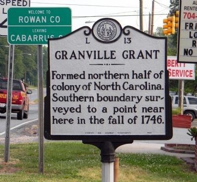
Granville Grant
Inscription.
Formed northern half of colony of North Carolina. Southern boundary surveyed to a point near here in the fall of 1746.
Erected 1938 by North Carolina Archives and Highway Departments. (Marker Number L-13.)
Topics and series. This historical marker is listed in this topic list: Settlements & Settlers. In addition, it is included in the North Carolina Division of Archives and History series list. A significant historical year for this entry is 1746.
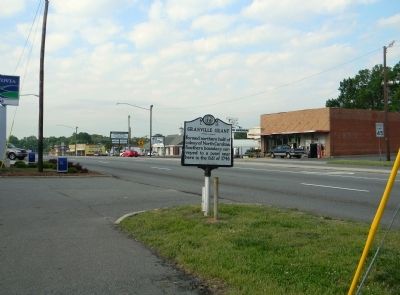
Location. 35° 30.283′ N, 80° 36.539′ W. Marker is in Kannapolis, North Carolina, in Cabarrus County. Marker is on North Cannon Boulevard (U.S. 29) 0.1 miles north of Venus Street, on the right when traveling north. Touch for map. Marker is at or near this postal address: 704 North Cannon Boulevard, Kannapolis NC 28083, United States of America. Touch for directions.
Other nearby markers. At least 8 other markers are within 6 miles of this marker, measured as the crow flies. Harvey Jeremiah Peeler House (approx. 0.9 miles away); Gem Theatre (approx. one mile away); "The Intimidator" (approx. 1.1 miles away); James W. Cannon (approx. 3.7 miles away); Charles A. Cannon (approx. 4.8 miles away); China Grove Roller Mill (approx. 4.9 miles away); Jefferson Davis Camp (approx. 5.2 miles away); Rural Free Delivery (approx. 5.7 miles away). Touch for a list and map of all markers in Kannapolis.
Also see . . . NCGenWeb Project : ~ Granville District and its Grants~. Granville District was a sixty-mile-wide strip of land crossing the colony of North Carolina next to the Virginia boundary. North Carolina was a proprietary colony originally, with eight Lords Proprietors owning the land from 1663 to 1729. In 1729, seven of those eight lords were persuaded to sell their land back to the English Crown. The eighth Lord Proprietor at that time was John Carteret, Baron Carteret of Hawnes in the County of Bedford; and he refused to sell his share back to the Crown(Submitted on May 19, 2011, by PaulwC3 of Northern, Virginia.)
Credits. This page was last revised on June 16, 2016. It was originally submitted on May 19, 2011, by PaulwC3 of Northern, Virginia. This page has been viewed 656 times since then and 13 times this year. Photos: 1, 2. submitted on May 19, 2011, by PaulwC3 of Northern, Virginia.

