Oak Grove in Jackson County, Missouri — The American Midwest (Upper Plains)
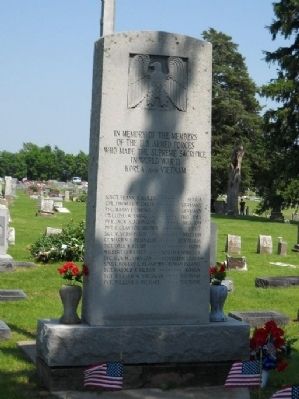
Oak Grove Veterans Memorial
In Memory of the Members of the U. S. Armed Forces who made the Supreme Sacrifice in World War II, Korea, and Vietnam
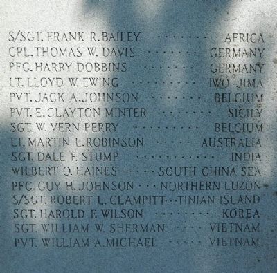
S/Sgt. Frank R. Bailey . . . Africa
Cpl. Thomas W. Davis . . . . Germany
PFC. Harry Dobbins . . . . . Germany
Lt. Lloyd W. Ewing . . . . . Iwo Jima
Pvt. Jack A. Johnson . . . . Belgium
Lt. Martin L. Robinson . . . Australia
Sgt. Dale F. Stump . . . . . India
Wilbert O. Haines . . . . . South China Sea
PFC. Guy H. Johnson . . . . Northern Luzon
S/Sgt. Robert L. Clampitt . Tinian Island
Sgt. Harold F. Wilson . . . Korea
Sgt. William W. Sherman . . Vietnam
Pvt. William A. Michael . . Vietnam
Erected by Citizens of the Oak Grove Community.
Topics. This memorial is listed in these topic lists: War, Korean • War, Vietnam • War, World II.
Location. 38° 59.283′ N, 94° 8.309′ W. Marker is in Oak Grove, Missouri, in Jackson County. Memorial is on SE Cemetery Road, 0.1 miles north of E Hillside School Road, on the right. Touch for map. Marker is in this post office area: Oak Grove MO 64075, United States of America. Touch for directions.
Other nearby markers. At least 8 other markers are within 14 miles of this marker, measured as the crow flies. Battle of Lone Jack (approx. 8.6 miles away); Santa Fe Trail (approx. 9.7 miles away); Potawatomi Trail of Death March (approx. 10˝ miles away); The Lewis and Clark Expedition Across Missouri (approx. 10.8 miles away); a different marker also named Santa Fe Trail (approx. 10.8 miles away); Fort Osage (approx. 11.2 miles away); Trail of Death (approx. 11.7 miles away); a different marker also named Potawatomi "Trail of Death" March (approx. 13.1 miles away).
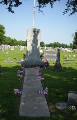
More about this memorial. Take the second entrance to the Cemetery - the Memorial is under a large Cedar Tree.
Credits. This page was last revised on June 16, 2016. It was originally submitted on May 30, 2011, by Thomas Onions of Olathe, Kansas. This page has been viewed 586 times since then and 15 times this year. Photos: 1, 2, 3, 4, 5, 6. submitted on May 30, 2011, by Thomas Onions of Olathe, Kansas.
