Asheboro in Randolph County, North Carolina — The American South (South Atlantic)
Pisgah Covered Bridge
1911
Historic Landmark
Pisgah Covered Bridge
1911
Designated March 1, 2010
Randolph County Bard of Commissioners
Historic Landmark Preservation Commission
Topics and series. This historical marker is listed in this topic list: Bridges & Viaducts. In addition, it is included in the Covered Bridges series list. A significant historical date for this entry is March 1, 1757.
Location. 35° 32.573′ N, 79° 53.59′ W. Marker is in Asheboro, North Carolina, in Randolph County. Marker is on Pisgah Covered Bridge Road, on the left when traveling south. Touch for map. Marker is at or near this postal address: 6925 Pisgah Covered Bridge Road, Asheboro NC 27205, United States of America. Touch for directions.
Other nearby markers. At least 8 other markers are within 13 miles of this marker, measured as the crow flies. Henderson Luelling (approx. 8.6 miles away); Plank Road (approx. 10.9 miles away); Pottery Industry (approx. 11.4 miles away); Sit-Ins for Civil Rights (approx. 12.1 miles away); Randolph County Confederate Monument (approx. 12.2 miles away); Randolph County Courthouse (approx. 12.2 miles away); Jonathan Worth (approx. 12.3 miles away); Presidential Visit (approx. 12.4 miles away). Touch for a list and map of all markers in Asheboro.
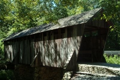
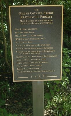
Regarding Pisgah Covered Bridge. Pisgah Covered Bridge was built in 1911. It is one of two remaining original historic covered bridges in North Carolina. The bridge crosses the west fork of the Little River in Randolph County, NC. This site was added to the National Register of Historic Places in 1972.
Credits. This page was last revised on June 16, 2016. It was originally submitted on June 4, 2011, by Paul Jordan of Burlington, N. C., U. S. A.. This page has been viewed 789 times since then and 14 times this year. Photos: 1, 2, 3, 4. submitted on June 4, 2011, by Paul Jordan of Burlington, N. C., U. S. A.. • Bill Pfingsten was the editor who published this page.


