Grant Grove Village in Tulare County, California — The American West (Pacific Coastal)
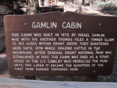
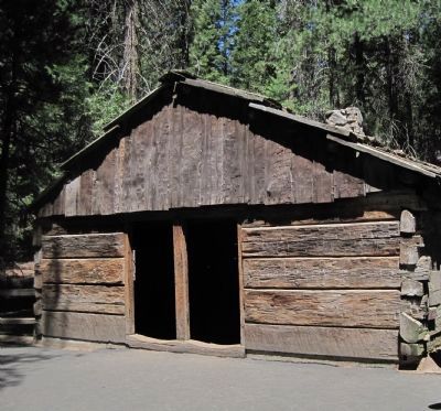
Gamlin Cabin
Topics. This historical marker is listed in this topic list: Notable Buildings. A significant historical year for this entry is 1872.
Location. 36° 44.886′ N, 118° 58.457′ W. Marker is in Grant Grove Village, California, in Tulare County. Marker can be reached from State Highway 180. This marker is located in Kings Canyon National Park at the General Grant Grove. The Grant Grove is reached by a short side road to the left starting 1.7 miles north of the CA 180 - CA 198 junction. From the parking lot take the .5 mile Grant Tree trail. Touch for map. Marker is in this post office area: Kings Canyon National Pk CA 93633, United States of America. Touch for directions.
Other nearby markers. At least 8 other markers are within 10 miles of this marker, measured as the crow flies. The Centennial Stump (within shouting distance of this marker); General Grant Tree Trail (about 400 feet away, measured in a direct line); The Fallen Monarch (about 700 feet away); Millwood (approx. 2 miles away); Converse Basin Grove (approx. 2.2 miles away); Technology in Timber County… (approx. 5.2 miles away); Buck Rock Lookout (approx. 6˝ miles away); Dunlap Cemetery (approx. 9.2 miles away).
Additional keywords. Redwoods
Credits. This page was last revised on June 16, 2016. It was originally submitted on July 7, 2011, by Barry Swackhamer of Brentwood, California. This page has been viewed 1,083 times since then and 43 times this year. Photos: 1, 2. submitted on July 7, 2011, by Barry Swackhamer of Brentwood, California. • Syd Whittle was the editor who published this page.

