Near Fish House in Fulton County, New York — The American Northeast (Mid-Atlantic)
Covered Bridge
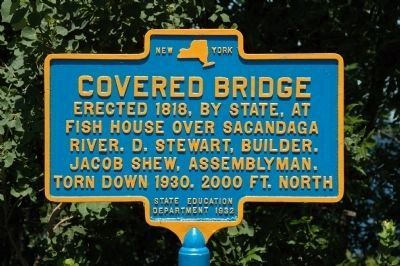
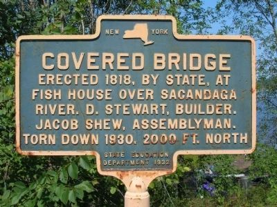
Erected 1818, by state, at Fish House over Sacandaga River. D. Stewart, builder. Jacob Shew, Assemblyman. Torn down 1930. 2000 Ft. North
Erected 1932 by New York State Education Department.
Topics and series. This historical marker is listed in these topic lists: Bridges & Viaducts • Notable Buildings. In addition, it is included in the Covered Bridges series list. A significant historical year for this entry is 1818.
Location. 43° 8.735′ N, 74° 7.794′ W. Marker is near Fish House, New York, in Fulton County. Marker is at the intersection of South Shore Road (County Route 110) and Fish House Road (County Route 109), on the right when traveling south on South Shore Road. Touch for map. Marker is in this post office area: Broadalbin NY 12025, United States of America. Touch for directions.
Other nearby markers. At least 8 other markers are within 2 miles of this marker, measured as the crow flies. "Fish House" (within shouting distance of this marker); St John House (within shouting distance of this marker); Marvin House (within shouting distance of this marker); Shew's Hill (about 600 feet away, measured in a direct line); Old Fish House (approx. 0.2 miles away); Shew House (approx. 0.3 miles away); Godfrey Shew (approx. 0.3 miles away); Hans' Creek (approx. 1.8 miles away). Touch for a list and map of all markers in Fish House.
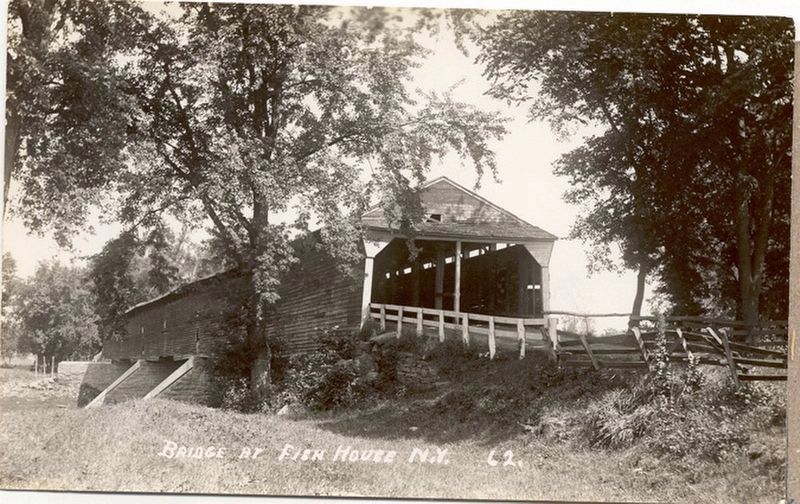
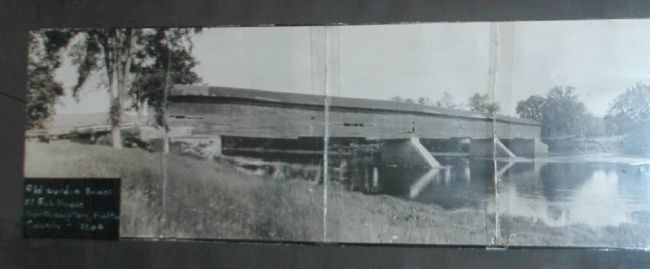
Regarding Covered Bridge. Completed in 1818, the Fish House Covered Bridge was considered the best-designed and best-constructed bridge in upstate New York. The massive 380 foot long double-barrel (two separate traffic lanes) bridge was constructed with wooden arches made from solid timbers over 100 feet in length. It has not been determined whether these were bent into the arch shape while they were green timbers or steamed later. The bridge remained in excellent condition for 112 years. The marker states the bridge was torn down, yet other sources state that the bridge was taken by the rising waters of the Sacandaga reservoir. Other bridges had been burned in the valley before the reservoir was filled.
Also see . . .
1. Sacandaga Valley Photo - Prior to Flooding. The Sacandaga Valley in 1929 showing the valley all cleared out but not yet flooded. The Fish House covered bridge is in the background. (Submitted on July 10, 2011, by Howard C. Ohlhous of Duanesburg, New York.)
2. Fish House, Fulton County. Covered Spans of Yesteryear website entry (Submitted on November 12, 2021, by Larry Gertner of New York, New York.)
Additional keywords. Sacandaga, Great Sacandaga Lake, Sacandaga Reservoir
Photographed By Howard C. Ohlhous, July 14, 2011
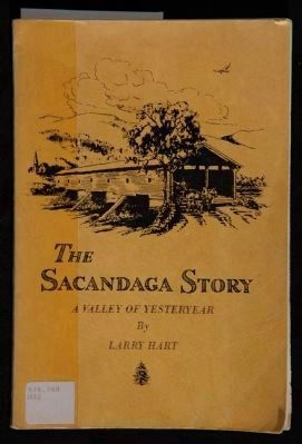
4. The Sacandaga Story
The Sacandaga Story - A Valley of Yesteryear " written by long time newspaper man and Schenectady City and County Historian, the late Larry Hart. His book, © 1967, is about the towns and the Sacandaga Valley wiped out by the creation of the Sacandaga Reservoir, offically renamed The Great Sacandaga Lake on August 29, 1968. The bookcover drawing,
"Fish House Bridge", by Walter J. Reagles, shows a romantic image of the Fishouse Covered Bridge, with three stone piers supporting the bridge. Photos of the bridge show only two piers.
Credits. This page was last revised on November 12, 2021. It was originally submitted on June 4, 2010, by Howard C. Ohlhous of Duanesburg, New York. This page has been viewed 998 times since then and 21 times this year. Last updated on July 10, 2011, by Howard C. Ohlhous of Duanesburg, New York. Photos: 1. submitted on July 10, 2011, by Howard C. Ohlhous of Duanesburg, New York. 2. submitted on June 4, 2010, by Howard C. Ohlhous of Duanesburg, New York. 3. submitted on November 12, 2021, by Larry Gertner of New York, New York. 4. submitted on July 14, 2011, by Howard C. Ohlhous of Duanesburg, New York. 5. submitted on September 26, 2013, by Howard C. Ohlhous of Duanesburg, New York. 6. submitted on June 4, 2010, by Howard C. Ohlhous of Duanesburg, New York. • Kevin W. was the editor who published this page.
