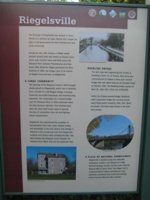
Riegelsville
During the late 18th century, a village slowly evolved around what was known an Shanks Ferry, which took travelers back and forth across the Delaware River between Pennsylvania and New Jersey. After Benjamin Riegel purchased the ferry business in 1806, the village came to be known as Riegels Ferry and later as Riegelsville.
A Canal Community
The opening of the Delaware Canal in 1832 brought steady growth to Riegelsville, which saw a transition from a hamlet to a full-fledged village, including numerous mercantile businesses and manufacturing industries. The construction of a covered bridge over the Delaware River in 1838 eventually made the ferry business obsolete. One hundred years later, the canal itself would cease to operate because of competition from rail and highway based transportation.
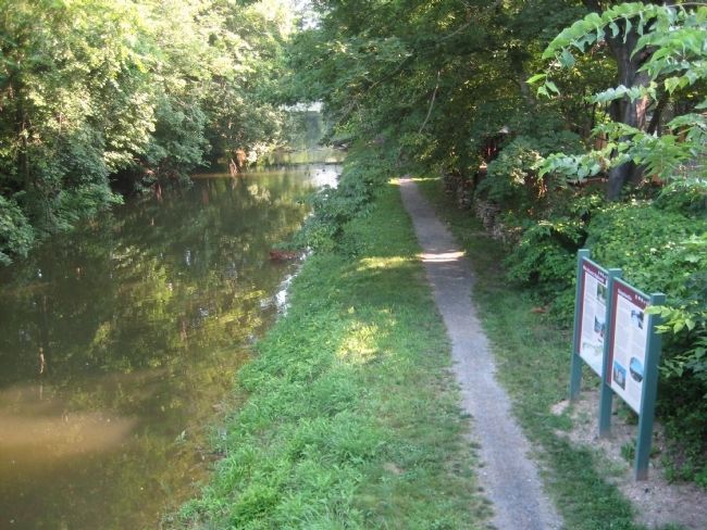
Riegelsville has experienced the evolution of transportation from river, canal, railroad, trolley and automobile. In the 21st century, this heritage is reflected in the recreational trails that Riegelsville residents and visitors enjoy including the D&L Trail, which follows the Delaware Canal Towpath, the Delaware River Water Trail and the Highlands
Trail.
Roebling Bridge
The wire rope and engineering firm of John A. Roebling's Sons, Co. of Trenton, New Jersey was commissioned to replace a three span covered bridge that was swept away by the Pumpkin Flood of 1903. The Roebling Bridge opened on April 18, 1904 with a final cost of $30,000.
Unlike the ill-fated covered bridge, Roebling's cable suspension bridge has survived several major flood events including 1936, 1955 (flood of record) and three major floods in the early 21st century.
A Place of National Significance
Riegelsville is situated along two nationally designated corridors: The Delaware & Lehigh National Heritage Corridor and the Lower Delaware National Wild & Scenic River. The village itself is a National Historic District that features many significant commercial and residential buildings dating from the 18th and 19th centuries.
Topics and series. This historical marker is listed in these topic lists: Bridges & Viaducts • Settlements & Settlers. In addition, it is included in the Delaware Canal (AKA Delaware Division of the Pennsylvania Canal) series list. A significant historical month for this entry is April 2004.
Location. 40° 35.628′ N, 75° 11.551′ W. Marker is in Riegelsville, Pennsylvania, in Bucks County. Marker can be reached from Delaware Road. The marker is located along
Other nearby markers. At least 8 other markers are within one mile of this marker, measured as the crow flies. Mid-Atlantic Highlands (here, next to this marker); Riegelsville Roebling Bridge (within shouting distance of this marker); Riegelsville Civil War Memorial (approx. ¼ mile away); The Riegelsville Academy and Public Library (approx. ¼ mile away); Riegelsville Historic District (approx. 0.3 miles away in New Jersey); Mt. Joy (approx. 0.4 miles away in New Jersey); Hunts Meadow (approx. ¾ mile away in New Jersey); Delaware Canal (approx. one mile away). Touch for a list and map of all markers in Riegelsville.
Credits. This page was last revised on June 16, 2016. It was originally submitted on July 19, 2011, by Alan Edelson of Union Twsp., New Jersey. This page has been viewed 1,300 times since then and 57 times this year. Photos: 1, 2. submitted on July 19, 2011, by Alan Edelson of Union Twsp., New Jersey. • Bill Pfingsten was the editor who published this page.

