Near Avery in Shoshone County, Idaho — The American West (Mountains)
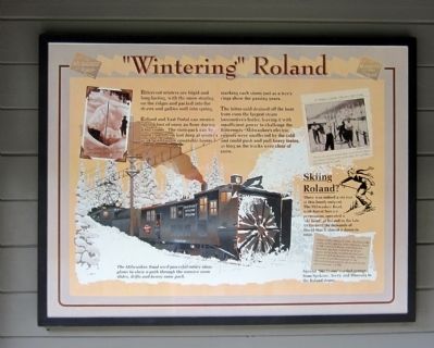
“Wintering” Roland
Bitterroot winters are frigid and long-lasting, with the snow staying on the ridges and packed into the draws and gullies well into the spring.
Roland and East Portal can receive up to a foot of snow an hour during a big storm. The snowpack can be twelve or fifteen feet deep at winter’s peak, piled up in countable layers, marking each storm just as a tree’s rings show the passing years.
The bitter cold drained off the heat from even the largest steam locomotive’s boiler, leaving it with insufficient power to challenge the Bitterroots. Milwaukee’s electric engines were unaffected by the cold and could push and pull heavy trains, as long as the tracks were clear of snow.
(sidebar)
Skiing Roland?
There was indeed a ski run at this lonely outpost. The Milwaukee Road, with Forest Service permission, operated a “ski bowl” at Roland in the late 1930s until the demands of World War II closed it down in 1941.
Special “Ski Trains” carried groups from Spokane, Avery, and Missoula to the Roland slopes.
Topics. This historical marker is listed in these topic lists: Railroads & Streetcars • Sports. A significant historical year for this entry is 1941.
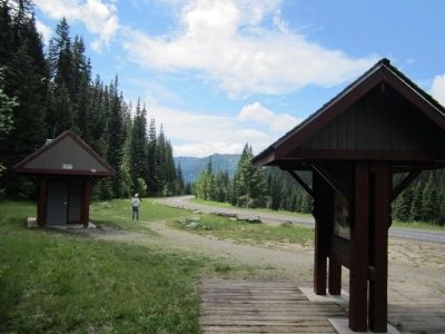
Location. 47° 22.574′ N, 115° 40.067′ W. Marker is near Avery, Idaho, in Shoshone County. Marker can be reached from Cliff Creek Road (Federal Road 506) 3.7 miles north of Loop Creek Road (Federal Road 326). Located along the Route of the Hiawatha Trail. Touch for map. Marker is in this post office area: Avery ID 83802, United States of America. Touch for directions.
Other nearby markers. At least 8 other markers are within 2 miles of this marker, measured as the crow flies. The Route of the Hiawatha (here, next to this marker); Beast of the Bitterroots (approx. ¼ mile away); Rough & Tumble Camps (approx. 0.3 miles away); Water Does the Work! (approx. 1.1 miles away); Man’s Mark on the Land (approx. 1.1 miles away); A Changing Landscape (approx. 1.1 miles away); Temporary Trestles (approx. 1.3 miles away); Tunneling Toward Tacoma (approx. 1.3 miles away). Touch for a list and map of all markers in Avery.
More about this marker. On the upper left is a photo with the caption, "Fourteen feet of snow and more on the way!"
On the lower left is a drawing with the caption, "The Milwaukee Road used powerful rotary snow plows to chew a path through the massive snow slides, drifts and heavy snow pack."
Also see . . . Route of the Hiawatha Rail Trail. (Submitted on August 4, 2011, by Bernard Fisher of Richmond, Virginia.)
Credits. This page was last revised on June 16, 2016. It was originally submitted on August 4, 2011, by Bernard Fisher of Richmond, Virginia. This page has been viewed 748 times since then and 8 times this year. Photos: 1, 2. submitted on August 4, 2011, by Bernard Fisher of Richmond, Virginia.

