Santa Fe in Santa Fe County, New Mexico — The American Mountains (Southwest)
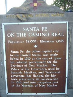
Santa Fe
On the Camino Real
— Population 58,000 - Elevation 7,045 —
Erected by New Mexico Historic Preservation Division.
Topics and series. This historical marker is listed in these topic lists: Exploration • Settlements & Settlers. In addition, it is included in the El Camino Real de Tierra Adentro series list. A significant historical year for this entry is 1610.
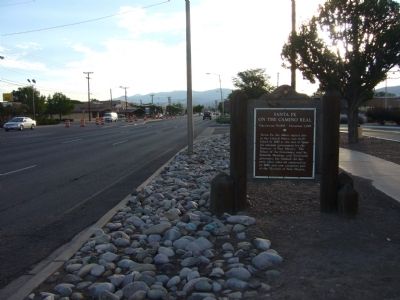
Location. 35° 39.552′ N, 105° 59.014′ W. Marker is in Santa Fe, New Mexico, in Santa Fe County. Marker is on Cerrillos Road (State Road 14) west of Camino Carlos Rey, on the right when traveling north. Touch for map. Marker is at or near this postal address: 2550 Cerrillos Road, Santa Fe NM 87505, United States of America. Touch for directions.
Other nearby markers. At least 8 other markers are within 3 miles of this marker, measured as the crow flies. San Isidro Catholic Church (approx. 1.2 miles away); Agua Fria (approx. 1.2 miles away); Fairview Cemetery (approx. 1.8 miles away); Marian Myer (approx. 1.8 miles away); Agricultural History (approx. 2.3 miles away); Acequia Madre (approx. 2.3 miles away); Railyard History (approx. 2˝ miles away); The Spiegelberg Brothers (approx. 2˝ miles away). Touch for a list and map of all markers in Santa Fe.
Credits. This page was last revised on October 28, 2021. It was originally submitted on August 4, 2011, by Bill Kirchner of Tucson, Arizona. This page has been viewed 894 times since then and 37 times this year. Photos: 1, 2, 3. submitted on August 4, 2011, by Bill Kirchner of Tucson, Arizona. • Bernard Fisher was the editor who published this page.


