Near Avery in Shoshone County, Idaho — The American West (Mountains)
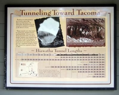
Tunneling Toward Tacoma
These tunnels were dug largely by hand using sledgehammers and hand drills. In some cases steam-powered drills and steam donkey engines were hauled to the work site to speed the digging. It took three years, and the toil of hundreds of men before the massive job was completed and the St. Paul Pass Tunnel was opened in March of 1909.
(sidebar)
Hiawatha Tunnel Lengths
Between Roland and Avery there are 16 tunnels varying in length from 178 to 1,516 feet long. The total length of all these tunnels is 8,557 feet, or just short of the length of the St. Paul Pass Tunnel alone. Nine of these tunnels are on the Route of the Hiawatha.
Topics. This historical marker is listed in this topic list: Railroads & Streetcars. A significant historical month for this entry is March 1909.
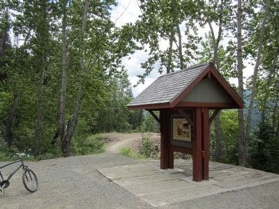
Location. 47° 21.677′ N, 115° 39.145′ W. Marker is near Avery, Idaho, in Shoshone County. Marker can be reached from Cliff Creek Road (Federal Road 506) 1.8 miles north of Loop Creek Road (Federal Road 326). Located along the Route of the Hiawatha Trail. Touch for map. Marker is in this post office area: Avery ID 83802, United States of America. Touch for directions.
Other nearby markers. At least 8 other markers are within 2 miles of this marker , measured as the crow flies. Temporary Trestles (a few steps from this marker); Section Gangs (approx. 0.6 miles away); A Changing Landscape (approx. 0.7 miles away); Water Does the Work! (approx. ¾ mile away); Man’s Mark on the Land (approx. ¾ mile away); No One’s “Fault” (approx. 0.8 miles away); Bridging the Gaps (approx. one mile away); Little in Name Only (approx. 1.2 miles away). Touch for a list and map of all markers in Avery.
More about this marker. On the upper right is a photo with the caption, "Superintendent Tom Walsh and his 1908 tunneling crew in the east heading of Tunnel #22 in front of you. Mostly recent immigrants, these sturdy hard-rock miners earned a dollar a day. Photograph courtesy, Montana Historical Society
Also see . . . Route of the Hiawatha Rail Trail. (Submitted on August 4, 2011, by Bernard Fisher of Richmond, Virginia.)
Credits. This page was last revised on June 16, 2016. It was originally submitted on August 4, 2011, by Bernard Fisher of Richmond, Virginia. This page has been viewed 585 times since then and 18 times this year. Photos: 1, 2. submitted on August 4, 2011, by Bernard Fisher of Richmond, Virginia.

