Near Avery in Shoshone County, Idaho — The American West (Mountains)
The Toughest Town
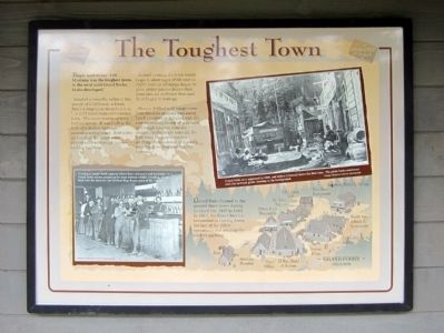
People used to say “Taft, Montana was the toughest town in the west until Grand Forks, Idaho developed.”
Located across the valley at the mouth of Cliff Creek, a Forest Service employee described it as,
“…a wild mushroom construction town. The main section of town had no streets. It was built in the form of a hollow rectangle around a sort of court. Both sides and ends of this court were almost solid with rough lumber and log buildings.
Toward the evening the town would begin to show signs of life and as night came on oil lamps began to glow, player pianos began their tinny din, an orchestra here and there began to tune up.
Women dabbed with rouge came from the cribs upstairs and sat at lunch counters or mingled with the gamblers and rough laborers from the camps. As the hours wore on, the little town became a roaring, seething, riotous brawl of drinking, dancing, gambling and fighting humanity.”
Grand Forks burned to the ground three times during its short life, 1907 to 1911. In 1911, the Forest Service succeeded in closing down the last of the illicit operations and sending the owners packing.
Topics. This historical marker is listed in this topic list: Railroads & Streetcars. A significant historical year for this entry is 1907.
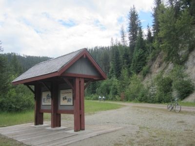
Location. 47° 21.029′ N, 115° 40.673′ W. Marker is near Avery, Idaho, in Shoshone County. Marker can be reached from Moon Pass Road, 0.4 miles south of Loop Creek Road (Federal Road 326). Located along the Route of the Hiawatha Trail. Touch for map. Marker is in this post office area: Avery ID 83802, United States of America. Touch for directions.
Other nearby markers. At least 8 other markers are within 2 miles of this marker, measured as the crow flies. Secluded Falcon (a few steps from this marker); World Class Workers (a few steps from this marker); "In the Hole" (a few steps from this marker); Smooth as Silk (approx. 0.7 miles away); Man’s Mark on the Land (approx. 0.9 miles away); A Changing Landscape (approx. 0.9 miles away); Water Does the Work! (approx. 0.9 miles away); Railroad at WAR! (approx. 1.4 miles away). Touch for a list and map of all markers in Avery.
More about this marker. On the lower left is a photo with the caption, "A camera’s bright flash captures elbow bent customers and bartender in a Grand Forks salon preparing for some serious whistle whetting. On the back wall the Austrian and Serbian flags honor some of the regulars." Montana Historical Society photograph
On the upper right is a photo with the caption, "Grand Forks as it appeared in 1909, just before it burned down the first time. The photo looks southwest with the railroad grade clearing in the background." Oregon Historical Society photograph
On the lower right is a drawing of "Grand Forks circa 1909"
Also see . . . Route of the Hiawatha Rail Trail. (Submitted on August 5, 2011, by Bernard Fisher of Richmond, Virginia.)
Credits. This page was last revised on June 16, 2016. It was originally submitted on August 5, 2011, by Bernard Fisher of Richmond, Virginia. This page has been viewed 716 times since then and 24 times this year. Photos: 1, 2. submitted on August 5, 2011, by Bernard Fisher of Richmond, Virginia.

