Near Avery in Shoshone County, Idaho — The American West (Mountains)
Not So "Lucky" Swedes
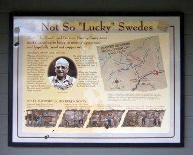
The Lucky Swede and Pearson Mining Companies used this siding to bring in mining equipment and hopefully, send out copper ore…
According to old-timer Harold Theriault,
“The lucky Swede Mine was a fairly large company, but only on paper. It had a number of investors, mostly from Minnesota, willing to finance the operations of the two Pearson brothers. Morris Pearson was responsible for the running of the mine, and Harry was the “brains” who attracted the large number of backers. The mine wasn’t profitable except on paper.”
The ambitious operation began 3.5 miles north of here, with the tunnel entrance located where the North Fork Road is now.
There was, however, at least one useful product from 22 years of mining here. The county used the tons of mine tailings to surface the North Fork Road.
(sidebar)
Mules, Machinemen, Muckers & Money
A weary mule, prodded by the mule skinner, hauls an ore cart of rock to the surface for milling.
Machinemen wrestle a noisy, awkward compressed air drill as it chews holes into the shaft face for explosives to blast the rock.
Blasters load a round by carefully fixing paper dynamite cartridges with rat-tail fuses for “shooting” the shaft face.
Muckers load the ore carts with the blasted ore and waste rock. The shift boss marks drill points on the face for the next round.
Topics. This historical marker is listed in these topic lists: Industry & Commerce • Railroads & Streetcars.
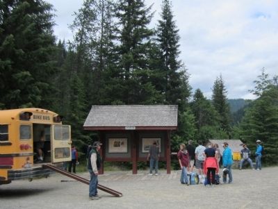
Location. 47° 21.114′ N, 115° 44.192′ W. Marker is near Avery, Idaho, in Shoshone County. Marker can be reached from Moon Pass Road (Federal Road 456) 0.4 miles south of Loop Creek Road (Federal Road 326). Located at the Route of the Hiawatha Trailhead. Touch for map. Marker is in this post office area: Avery ID 83802, United States of America. Touch for directions.
Other nearby markers. At least 8 other markers are within 2 miles of this marker, measured as the crow flies. The Route of the Hiawatha (here, next to this marker); Busy Bogle Spur (here, next to this marker); The End of the Road? (a few steps from this marker); Bumps on the Milwaukee Road (approx. 0.4 miles away); Rough Roads & Wrecks (approx. 0.6 miles away); Laboring in Luxury (approx. one mile away); You want to be a Ranger? (approx. 1.1 miles away); Railroad at WAR! (approx. 1˝ miles away). Touch for a list and map of all markers in Avery.
More about this marker. On the left is a photo of "Harold Theriault".
On the upper right is a map of Pearson Brothers Mining Operations (circa, 1926) with the caption, "The Lucky Swede Gold and Copper Mining Company started operations in 1909, then reorganized in 1920 as the Pearson Mining Company. By 1922 the mine’s main tunnel reached 1,950 feet and by 1931 had been pushed to 3,800 feet. About six people worked in the mine on a regular basis. However, after 22 years of effort the company failed to find any ore in commercial quantity."
Also see . . . Route of the Hiawatha Rail Trail. (Submitted on August 5, 2011, by Bernard Fisher of Richmond, Virginia.)
Credits. This page was last revised on June 16, 2016. It was originally submitted on August 5, 2011, by Bernard Fisher of Richmond, Virginia. This page has been viewed 728 times since then and 31 times this year. Photos: 1, 2. submitted on August 5, 2011, by Bernard Fisher of Richmond, Virginia.

