Cascade near Colorado Springs in El Paso County, Colorado — The American Mountains (Southwest)
A New Home in the Hills
Photographed By Charles T. Harrell, July 1, 2011
1. A New Home in the Hills Marker
Inscription.
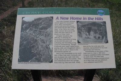
A New Home in the Hills. . Soon after President Abraham Lincoln signed the Homestead Act in 1862, homesteaders moved west across the prairies and spread into the hills of Pikes Peak. In the 1870s, the Crowe family claimed 160 acres in this valley that later came to be known as Crowe Gulch.
At high elevations, the difficulty of satisfying the Homestead requirement of living on the land five years and cultivating and harvesting a crop could be overwhelming. Meager livelihoods were made cutting timber, grazing cattle, and struggling to raise a stalk or two of corn or beans in the decomposed granite soil.
Most of the homesteads on the south side of Pikes Peak were eventually sold and developed into rustic hotel sites along hiking trails to the summit. They were abandoned when the Carriage Road and Cog Train were built. Public land on this, the north side of the mountain was purchased for the road right-of-way and reservoirs.
Homesteading on the slopes of Pikes Peak came to a halt in 1892 when Congress established timber reservations on public lands. The Pikes Peak timberland Reservation included almost all of Pikes Peak and was withdrawn from settlement opportunities.
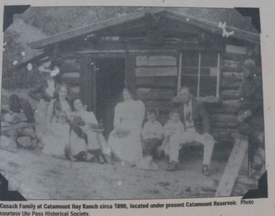
(caption: Cusack Family at Catamount Hay Ranch circa 1890, located under present Catamount Reservoir. Photo courtesy Ute Pass Historical Society)
Soon after President Abraham Lincoln signed the Homestead Act in 1862, homesteaders moved west across the prairies and spread into the hills of Pikes Peak. In the 1870s, the Crowe family claimed 160 acres in this valley that later came to be known as Crowe Gulch.
At high elevations, the difficulty of satisfying the Homestead requirement of living on the land five years and cultivating and harvesting a crop could be overwhelming. Meager livelihoods were made cutting timber, grazing cattle, and struggling to raise a stalk or two of corn or beans in the decomposed granite soil.
Most of the homesteads on the south side of Pikes Peak were eventually sold and developed into rustic hotel sites along hiking trails to the summit. They were abandoned when the Carriage Road and Cog Train were built. Public land on this, the north side of the mountain was purchased for the road right-of-way and reservoirs.
Homesteading on the slopes of Pikes Peak came to a halt in 1892 when Congress established timber reservations on public lands. The Pikes Peak timberland Reservation included almost all of Pikes Peak and was withdrawn from settlement opportunities.
(caption: Cusack Family at Catamount Hay Ranch circa 1890, located under present Catamount Reservoir. Photo courtesy Ute Pass Historical Society)
Topics. This historical marker is listed
Click or scan to see this page online
in this topic list: Settlements & Settlers. A significant historical year for this entry is 1862.
Location. 38° 54.034′ N, 104° 59.495′ W. Marker is near Colorado Springs, Colorado, in El Paso County. It is in Cascade. Marker is on Pike's Peak Toll Road. Marker is located at the Crowe Gulch turnout. Touch for map. Marker is in this post office area: Cascade CO 80809, United States of America. Touch for directions.
2. Cusack Family at Catamount Hay Ranch circa 1890, located under present Catamount Reservoir
Photo courtesy Ute Pass Historical Society
Photographed By Charles T. Harrell, July 1, 2011
3. Pikes Peak Settlement
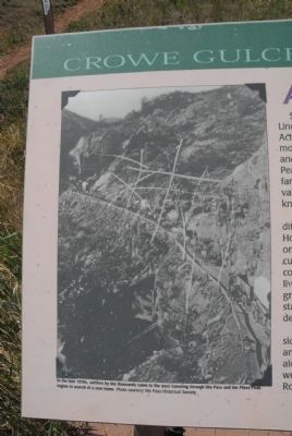
In the late 1870s, settlers by the thousands came to the west traveling through Ute Pass and the Pikes Peak region in search of a new home. Photo courtesy Ute Pass Historical Society.
Credits. This page was last revised on February 7, 2023. It was originally submitted on August 10, 2011, by Charles T. Harrell of Woodford, Virginia. This page has been viewed 887 times since then and 36 times this year. Photos:1, 2, 3. submitted on August 10, 2011, by Charles T. Harrell of Woodford, Virginia. • Bill Pfingsten was the editor who published this page.