Perryville in Boyle County, Kentucky — The American South (East South Central)
First Settlement of Perryville
Perryville • The Battle For Kentucky
— October 8, 1862 —
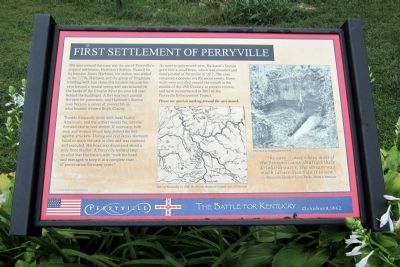
Trouble frequently arose with local Native Americans, and the settlers would flee into the fort and cave to seek shelter. If necessary, both men and women would help defend the fort against attackers. During one raid James Harbison failed to reach the cave in time and was captured and executed. His head was discovered about a mile from the fort. A Perryville resident later recalled that Harbison’s wife “took the head and managed to keep it in a complete state of preservation for many years.”
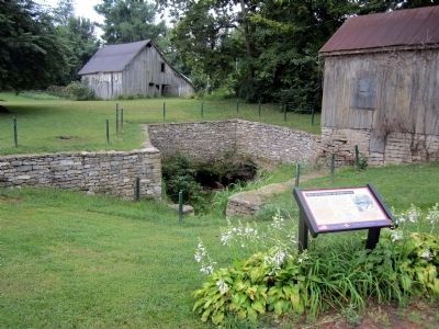
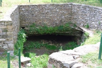
As more people moved west, Harbison’s Station grew into a small town, which was renamed and incorporated as Perryville in 1817. The cave remained a popular site for social events. Stone walls were installed around the mouth in the middle of the 19th Century to prevent erosion, and were reconstructed in 2007 by the Perryville Enhancement Project.
Please use caution walking around the cave mouth.
“The cave…was where most of the Perryvillians obtained their drinking water. The stream was much larger then than it is now.”
—Perryville resident Lora Parks, from a memoir
Erected by The Perryville Enhancement Project.
Topics. This historical marker is listed in these topic lists: Forts and Castles • Settlements & Settlers. A significant historical year for this entry is 1817.
Location. 37° 38.889′ N, 84° 57.13′ W. Marker is in Perryville, Kentucky, in Boyle County. Marker is at the intersection of West Fourth Street and South Buell Street (U.S. 68), on the left when traveling west on West Fourth Street. Touch for map. Marker is in this post office area: Perryville KY 40468, United States of America. Touch for directions.
Other nearby markers. At least 8 other markers are within walking distance of this marker. Karrick-Parks House / Harberson's Station (a few steps from this marker); Perryville in the Crucible of War (about 400 feet away, measured in a direct line); “If You Meet the Enemy, Overpower Him” (about 400 feet away); The City of Perryville (about 400 feet away); Bragg's Invasion of Kentucky (about 500 feet away); The Battle of Perryville (about 500 feet away); Merchants' Row / Street Fighting (about 700 feet away); a different marker also named Battle of Perryville (approx. 0.2 miles away). Touch for a list and map of all markers in Perryville.
More about this marker. In the center is a map of “Central Kentucky in 1784. Harbison’s Station is located west of Danville.”
On the upper right is a photograph of “The cave as it appeared in 1929.”
Additional commentary.
1. David Potts and the James Harbison Encounter with Native Americans
My ancestor, David Potts, was in the field with Harbison when they were encountered by the “indians.”
David was chased across the river and to the cave by one of them carrying a rifle. David shot and killed him. David stayed all night in the cave. The next morning he retrieved the rifle, but had to cut off the man’s trigger finger to do so.
This story was related many times to John Henry by his mother Margaret Potts Henry, one of David’s daughters. Note To Editor only visible by Contributor and editor
— Submitted March 7, 2022, by George Dallas Potts of Gypsum, Kansas.
Credits. This page was last revised on March 13, 2022. It was originally submitted on August 23, 2011, by Bernard Fisher of Richmond, Virginia. This page has been viewed 1,405 times since then and 68 times this year. Photos: 1, 2. submitted on August 23, 2011, by Bernard Fisher of Richmond, Virginia. 3. submitted on September 15, 2015, by Brandon Fletcher of Chattanooga, Tennessee.


