Madison Heights in Amherst County, Virginia — The American South (Mid-Atlantic)
Williams Viaduct
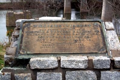
Inscription.
This bridge was erected by Norfolk & Western Railway Co., Chesepeake & Ohio Railway Co., Southern Railway Co., City of Lynchburg, Va. Begun 1916. Completed 1918. Bridge Commissioners Ernest Williams, Chairman; William King, Jr.; John P. Pettyjohn.
Topics. This historical marker is listed in this topic list: Bridges & Viaducts. A significant historical year for this entry is 1916.
Location. 37° 25.15′ N, 79° 8.282′ W. Marker is in Madison Heights, Virginia, in Amherst County. Marker is on River Road just south of South Amherst Highway (U.S. 163), on the right when traveling south. Touch for map. Marker is in this post office area: Madison Heights VA 24572, United States of America. Touch for directions.
Other nearby markers. At least 8 other markers are within walking distance of this marker. Amherst County / Campbell County (about 500 feet away, measured in a direct line); Civil War Lynchburg (approx. ¼ mile away); Point of Honor (approx. 0.3 miles away); Nuclear Ship Savannah (approx. 0.4 miles away); Lynchburg History (approx. 0.4 miles away); Point of Beginning (approx. 0.4 miles away); The Ladies Relief Hospital (approx. 0.4 miles away); a different marker also named Lynchburg History (approx. 0.4 miles away).
More about this marker. Marker was probably originally on the bridge, and put here on the concrete and stone pedestal after it was demolished.
Regarding Williams Viaduct. The Williams Viaduct was demolished in 1988, replaced by the John Lynch Bridge in use today. It carried U.S. 29 into Lynchburg until the Route 29 bypass was completed in 2006.

Photographed By J. J. Prats, April 9, 2011
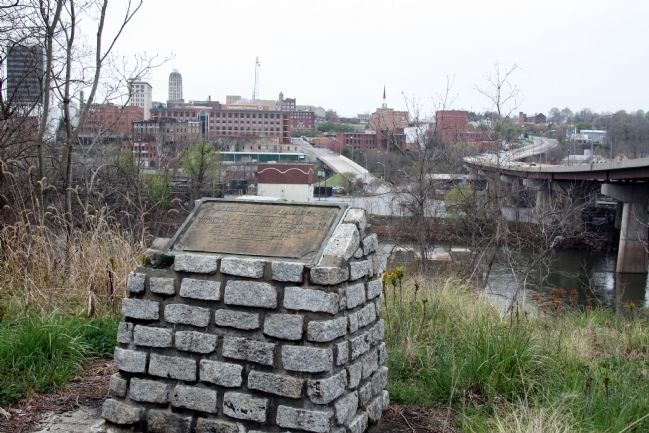
2. Williams Viaduct Marker and Lynchburg Skyline
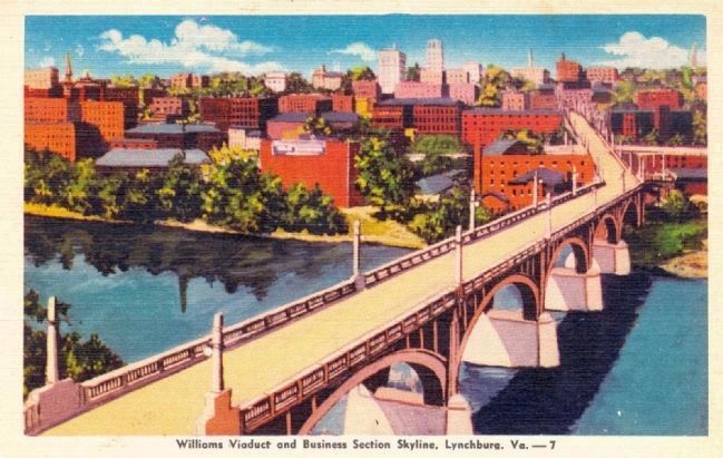
Compare today’s skyline with the one on the postcard reproduced below. The 7th Street approach to the viaduct can be seen directly above and a bit to the right of the marker. The new bridge on the right curves to land on 5th Street in Lynchburg.

J. J. Prats Postcard Collection
3. Williams Viaduct and Business Section Skyline, Lynchburg, Va. — 7
Postcard published by Strother Drug Co., Lynchburg. “Colorcraft—Dexter Press, Pearl River, NY.” It is not dated, but the streetcar tracks that were on the bridge when it was built are not showing. Streetcar service in Lynchburg ended in 1941.
Credits. This page was last revised on August 15, 2021. It was originally submitted on August 26, 2011, by J. J. Prats of Powell, Ohio. This page has been viewed 1,101 times since then and 71 times this year. Photos: 1, 2, 3. submitted on August 26, 2011, by J. J. Prats of Powell, Ohio.
