Marker Logo HMdb.org THE HISTORICAL
MARKER DATABASE
“Bite-Size Bits of Local, National, and Global History”
New Albany in Floyd County, Indiana — The American Midwest (Great Lakes)
 

Scribner High School


Scribner High School Marker image. Click for full size.
Photographed By Courtesy:: Marilyn S. Wolf, August 28, 2011
1. Scribner High School Marker
Inscription. In 1880, an 1822 school building on this site became Scribner High School for African-American students, under an 1869 Indiana law mandating public education for African-American children and allowing segregated schools. Modern facility completed and state commissioned 1907. Closed 1952 after 1949 state desegregation law.
 
Erected 1998 by Indiana Historical Bureau and Southern Christian Leadership Conference. (Marker Number 22.1998.1.)
 
Topics and series. This historical marker is listed in these topic lists: African AmericansEducation. In addition, it is included in the Indiana Historical Bureau Markers series list. A significant historical year for this entry is 1880.
 
Location. 38° 17.109′ N, 85° 49.511′ W. Marker is in New Albany, Indiana, in Floyd County. Marker is at the intersection of West Spring Street and West 1st Street, on the left when traveling west on West Spring Street. Located on the North/East lawn of the City-County Building of New Albany / Floyd County in New Albany, Indiana. Touch for map. Marker is in this post office area: New Albany IN 47150, United States of America. Touch for directions.
 
Other nearby markers. At least 8 other markers are within walking distance of this marker. City-County Building (a few steps from this marker); Floyd County's Bicentennial Bison (a few steps from this marker); Market House
Paid Advertisement
Click on the ad for more information.
Please report objectionable advertising to the Editor.
Click or scan to see
this page online
(about 400 feet away, measured in a direct line); Old New Albany (about 600 feet away); The Israel House (approx. 0.2 miles away); Mob Violence, 1862 (approx. 0.2 miles away); New Albany Downtown Historic District (approx. 0.2 miles away); Scribner House (approx. 0.2 miles away). Touch for a list and map of all markers in New Albany.
 
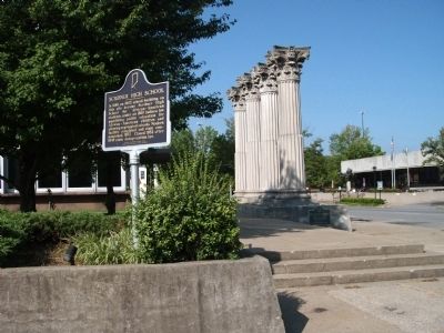
Obverse SIde - - Scribner High School Marker image. Click for full size.
Photographed By Courtesy:: Marilyn S. Wolf, August 28, 2011
2. Obverse SIde - - Scribner High School Marker
Looking West - - Scribner High School Marker image. Click for full size.
Photographed By Courtesy:: Marilyn S. Wolf, August 28, 2011
3. Looking West - - Scribner High School Marker
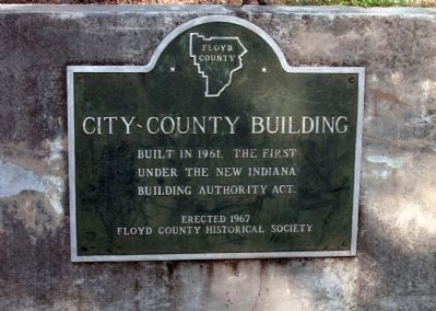
Plaque - - City-County Building image. Click for full size.
Photographed By Courtesy:: Marilyn S. Wolf, August 28, 2011
4. Plaque - - City-County Building
East Side - - City-County Building (New Albany / Floyd County) image. Click for full size.
Photographed By Courtesy:: Marilyn S. Wolf, August 28, 2011
5. East Side - - City-County Building (New Albany / Floyd County)
North/East Corner - - New Albany/Floyd County - - City-County Building image. Click for full size.
Photographed By Courtesy:: Marilyn S. Wolf, August 28, 2011
6. North/East Corner - - New Albany/Floyd County - - City-County Building
 
 
Credits. This page was last revised on June 16, 2016. It was originally submitted on August 29, 2011, by Al Wolf of Veedersburg, Indiana. This page has been viewed 676 times since then and 49 times this year. Photos:   1, 2, 3, 4, 5, 6. submitted on August 29, 2011, by Al Wolf of Veedersburg, Indiana. • Bill Pfingsten was the editor who published this page.


Share this page.  
Share on Tumblr
m=46624

CeraNet Cloud Computing sponsors the Historical Marker Database.
This website earns income from purchases you make after using our links to Amazon.com. We appreciate your support.
Paid Advertisement
Apr. 26, 2024