Mesquite in Clark County, Nevada — The American Mountains (Southwest)
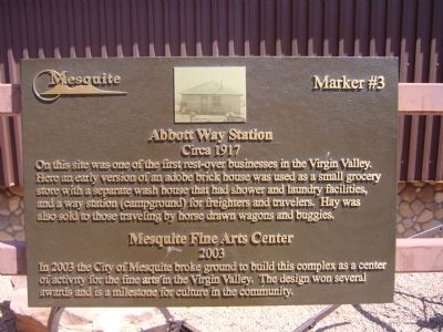
Abbott Way Station
Circa 1917
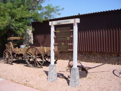
On this site was one of the first rest-over businesses in the Virgin Valley. Here an early version of an adobe brick house was used as a small grocery store with a separate wash house that had shower and laundry facilities, and a way station (campground) for freighters and travelers. Hay was also sold to those traveling by horse drawn wagons and buggies.
2003
Erected by City of Mesquite. (Marker Number 3.)
Topics. This historical marker is listed in these topic lists: Arts, Letters, Music • Industry & Commerce. A significant historical year for this entry is 2003.
Location. 36° 48.246′ N, 114° 4.115′ W. Marker is in Mesquite, Nevada, in Clark County. Marker is on West Mesquite Boulevard, on the right when traveling west. Touch for map. Marker is at or near this postal address: 35 West Mesquite Boulevard, Mesquite NV 89027, United States of America. Touch for directions.
Other nearby markers. At least 8 other markers are within walking distance of this marker. Museum and Fire House (here, next to this marker); Virgin Valley (here, next to this marker); The Old Spanish Trail (within shouting distance of this marker); Egg House / Telephone Building (within shouting distance of this marker); Tithing Lot (about 500 feet away, measured in a direct line); History of Mesquite (about 600 feet away); Mary Jane Leavitt Abbott (about 600 feet away); William Elias Abbott (about 600 feet away). Touch for a list and map of all markers in Mesquite.
Credits. This page was last revised on December 20, 2020. It was originally submitted on September 1, 2011, by Bill Kirchner of Tucson, Arizona. This page has been viewed 552 times since then and 13 times this year. Photos: 1, 2, 3. submitted on September 1, 2011, by Bill Kirchner of Tucson, Arizona. • Syd Whittle was the editor who published this page.
Editor’s want-list for this marker. Photo of the Fine Arts building. • Can you help?


