Merriam in Johnson County, Kansas — The American Midwest (Upper Plains)
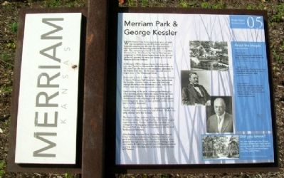
Merriam Park & George Kessler
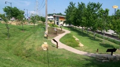
Merriam Historic Plaza Walking Path
With Kansas City becoming a focal point of trade and transportation, the Fort Scott and Gulf Railroad company saw the need for an amusement park to entertain the booming population in the area. The company purchased forty acres to establish Merriam Park. Developed by Charles Merriam and completed in 1880, it was located next to the railroad tracks and spanned the area now known as I-35 and Shawnee Mission Parkway.
In the early 1880's, Kansas Citians left the city by train and flocked to Merriam for weekend retreats at Merriam Park, the first private recreation attraction in the Kansas City area. At the time, the park was the largest west of the Mississippi River.
Dedicated on July 3, 1880 by former President Ulysses S. Grant, Merriam Park featured a large lagoon used for boating, a shelter house, a dance pavilion large enough for twenty sets of dancers, a zoo, and a horse-driven (and later steam-powered) carousel.
Upon arriving at the park, visitors passed through a main arched gateway where the name "Merriam" was spelled out in flowers. For twenty-five cents, park visitors could take advantage of all the park amenities including picnic areas, croquet grounds, tennis courts, and a baseball diamond.
Much of the park remained in a natural state, and the wooded areas were home to a herd of deer. Within this area, animals were free to roam.
The beauty of the park was due in large part to landscape architect George Kessler, who served as park superintendent. Kessler molded the non-descript acreage into an engaging railroad excursion park. Merriam Park was Kessler's first project in the field of landscape architecture.
After leaving Merriam Park, Kessler became Kansas City's landscape architect and developed the city's park and boulevard system. Kessler went on to direct projects throughout the United States. During his 40-year career, Kessler completed over 230 known projects and was one of the founders of the American Institute of Planners.
About the Images
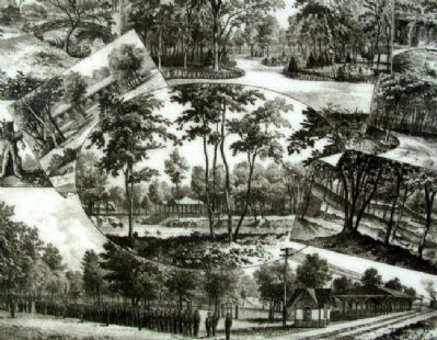
Merriam Park -
Lithograph of Merriam Park, scenes include the lagoon, the tabernacle, the railroad entrance, and numerous roadways.
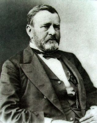
Ulysses S. Grant -
Half-length portrait of President Ulysses S. Grant created between 1865 and 1885 by the studios of Matthew Brady and Levin C. Handy.
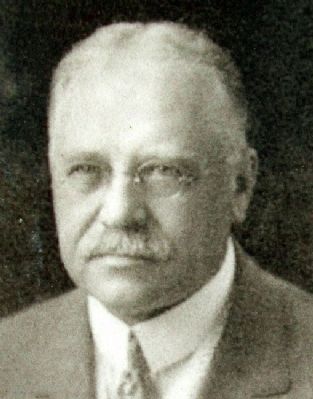
George Kessler -
Kessler was born in Germany in 1862. His first three major projects were Merriam Park, and two projects in Kansas City Missouri, Hyde Park and the Park and Boulevard System of Kansas City, Missouri.
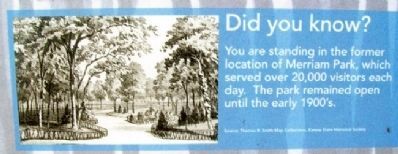
Did you know?
You are standing in the former location of Merriam Park, which served over 20,000 visitors each day. The park remained
open until the early 1900's.
Erected 2006 by City of Merriam. (Marker Number 05.)
Topics and series. This historical marker is listed in these topic lists: Entertainment • Railroads & Streetcars. In addition, it is included in the Former U.S. Presidents: #18 Ulysses S. Grant series list. A significant historical date for this entry is July 3, 1880.
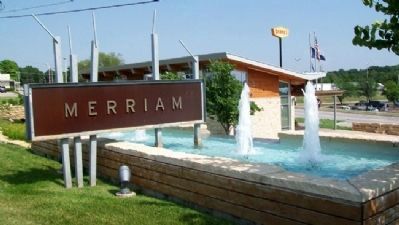
Location. 39° 0.872′ N, 94° 41.438′ W. Marker is in Merriam, Kansas, in Johnson County. Marker is at the Merriam Visitors Bureau, near Exit #228B of Interstate 35, and immediately southwest of the intersection of Shawnee Mission Parkway (US 56) and Eby Avenue. Touch for map. Marker is at or near this postal address: 6304 East Frontage Road, Mission KS 66202, United States of America. Touch for directions.
Other nearby markers. At least 8 other markers are within walking distance of this marker. The Trolley Line & Hocker Grove Amusement Park (here, next to this marker); The Founding of Campbellton (here, next to this marker); The Overland Trails (a few steps from this marker); Shawnee Friends Mission (a few steps from this marker); The Bear Pit (a few steps from this marker); The People of the South Wind & the Coming of the Shawnee (a few steps from this marker); Education in Merriam (within shouting distance of this marker); The South Park Community (within shouting distance of this marker). Touch for a list and map of all markers in Merriam.
Also see . . .
1. George Kessler and Merriam Park. Geroge E. Kessler - City Planner website entry (Submitted on September 6, 2011, by William Fischer, Jr. of Scranton, Pennsylvania.)
2. Explore Merriam, Kansas. Town website homepage (Submitted on September 6, 2011, by William Fischer, Jr. of Scranton, Pennsylvania.)
Credits. This page was last revised on January 31, 2022. It was originally submitted on September 6, 2011, by William Fischer, Jr. of Scranton, Pennsylvania. This page has been viewed 1,003 times since then and 84 times this year. Photos: 1, 2, 3, 4, 5, 6, 7. submitted on September 6, 2011, by William Fischer, Jr. of Scranton, Pennsylvania.
