Farson in Sweetwater County, Wyoming — The American West (Mountains)
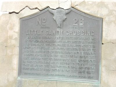
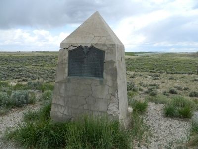
Little Sandy Crossing
Erected 1933 by Utah Pioneer Trails & Landmarks Association & Members of Lyman Stake. (Marker Number 26.)
Topics and series. This historical marker is listed in these topic lists: Churches & Religion • Exploration • Settlements & Settlers. In addition, it is included in the Mormon Pioneer Trail, and the Utah Pioneer Trails and Landmarks Association series lists. A significant historical date for this entry is June 28, 1860.
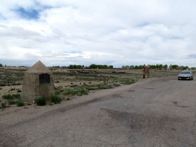
Location. 42° 6.481′ N, 109° 27.194′ W. Marker is in Farson, Wyoming, in Sweetwater County. Marker is on State Highway 28, 0.1 miles west of U.S. 191, on the right when traveling west. Touch for map. Marker is in this post office area: Farson WY 82932, United States of America. Touch for directions.
Other nearby markers. At least 8 other markers are within 10 miles of this marker, measured as the crow flies. The Big Sandy River (a few steps from this marker); To the Brave Men Who Rode the Pony Express (approx. 0.2 miles away); To All Pioneers Who Passed This Way to Win and Hold the West (approx. 7.9 miles away); a different marker also named Little Sandy Crossing (approx. 8.1 miles away); Burning Wagons (approx. 9.4 miles away); Simpson's Hollow (approx. 9.4 miles away); The Utah War (approx. 9.4 miles away); a different marker also named Simpson's Hollow (approx. 9.4 miles away). Touch for a list and map of all markers in Farson.
Credits. This page was last revised on June 16, 2016. It was originally submitted on September 14, 2011, by Bill Pfingsten of Bel Air, Maryland. This page has been viewed 794 times since then and 29 times this year. Photos: 1, 2. submitted on September 14, 2011, by Bill Pfingsten of Bel Air, Maryland. 3. submitted on January 23, 2014, by Duane Hall of Abilene, Texas.


