Governors Island in Manhattan in New York County, New York — The American Northeast (Mid-Atlantic)
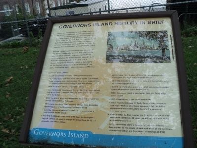
Governors Island History in Brief
Governors Island
Governors Island boasts a long military history and has played an important role in every major American military engagement since the Revolutionary War, including the War of 1812, the Civil War, World War I, World War II and the Gulf War. First settled by the Dutch in 1624, the Island became a permanent US Army facility after 1800, and more recently, the Atlantic Area headquarters of the US Coast Guard.
Original Lenape Indian residents may have called the Island “Pagganack,” a name that refers to the abundance of nut trees. The subsequent Dutch occupants called the Island “Nooten Eyland,” their translation of Pagganack. In the late 1700s, Britain designated Governors Island as belonging to “His Majesty’s Governors,” thus generating the name “Governors Island,” which it retains to this day.
Governors Island Timeline
• 1524: Giovanni da Verazzano sights Governors Island
• 1624: The Island is the first place settled by the Dutch West India Company in New York Harbor. They erect a sawmill and the timber is used in the building of New Amsterdam.
• 1698: The British officially acquire the Island.
• 1776: Continental troops under George Washington occupy and fortify the Island. Later that year, the Island and New York City fall to the British.
• 1783: The British Royal Navy surrenders the Island to Governor George Clinton of New York State.
• 1794: Using volunteers from Columbia College (now Columbia University), a new fort is constructed on the Island.
1833: The Ordnance Department of the Army establishes a major arsenal on the Island.
• 1901-1912: 4,787,000 cubic yards of fill from the Lexington Avenue Subway are used to enlarge the Island from 69 to 172 acres at a cost of $1.1 million.
• 1909: Wilbur Wright takes off from the Island, successfully making the first flight over American waters.
• 1914-1918: Island is a major supply base and embarkation point for troops engaged in WWI
• 1939-1945: Island plays a role as a WWII administration center and chief reception center for inductees.
• 1966: Governors Island is transferred from the Army to the Coast Guard.
• 1996: Coast Guard leaves Governors Island.
• 2002: President George W. Bush, Governor George Pataki and Mayor Michael Bloomberg announce that the federal government will sell the Island back to the people of New York for $1.
• 2003: George W. Bush creates the Governors Island National Monument comprising 22 acres owned and operated by the National Park Service.
• 2003: Governors Island is transferred from the Federal Government to the people of New York through the Governors Island Preservation and Education Corporation (GIPEC).
Topics. This historical marker is listed in this topic list: Notable Places. A significant historical year for this entry is 1812.
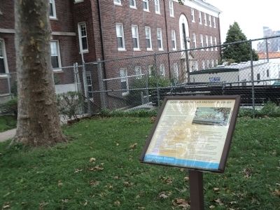
Location. 40° 41.556′ N, 74° 1.021′ W. Marker is in Manhattan, New York, in New York County. It is on Governors Island. Marker is on Andes Road, on the right when traveling west. Marker is located on Governors Island. Touch for map. Marker is in this post office area: New York NY 10004, United States of America. Touch for directions.
Other nearby markers. At least 8 other markers are within walking distance of this marker. Andes Road (here, next to this marker); Governors Island (about 400 feet away, measured in a direct line); Early North American Colonist Remains (about 400 feet away); In Memory Of Alexander Kidd (about 500 feet away); Castle Williams (about 500 feet away); a different marker also named Castle Williams (about 500 feet away); Group Effort (about 600 feet away); a different marker also named Castle Williams (about 600 feet away). Touch for a list and map of all markers in Manhattan.
More about this marker. A photo at the upper right of the marker depicts the “New York Skyline from Governors Island, showing Financial Center of the World, New York City.”
Also see . . .
1. The Trust for Governors Island. Website homepage (Submitted on September 14, 2011, by Bill Coughlin of Woodland Park, New Jersey.)
2. Governors Island National Monument. National Park Service website. (Submitted on September 14, 2011, by Bill Coughlin of Woodland Park, New Jersey.)
Credits. This page was last revised on February 18, 2024. It was originally submitted on September 14, 2011, by Bill Coughlin of Woodland Park, New Jersey. This page has been viewed 618 times since then and 20 times this year. Photos: 1, 2, 3. submitted on September 14, 2011, by Bill Coughlin of Woodland Park, New Jersey.


