Marker Logo HMdb.org THE HISTORICAL
MARKER DATABASE
“Bite-Size Bits of Local, National, and Global History”
Near Comer in Oglethorpe County, Georgia — The American South (South Atlantic)
 

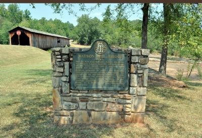
Watson Mill Bridge


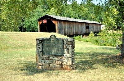
Watson Mill Bridge Marker image. Click for full size.
Photographed By David Seibert, September 3, 2011
1. Watson Mill Bridge Marker
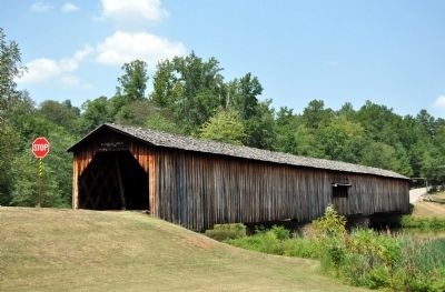
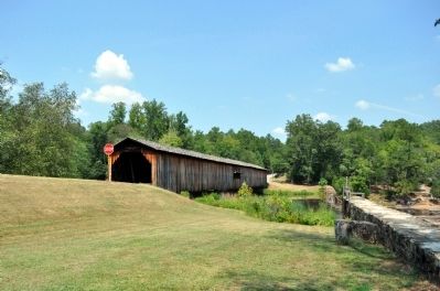
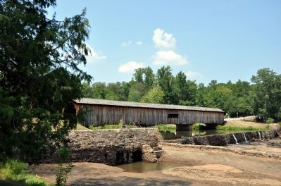
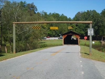
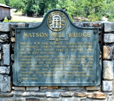
Inscription. Built by W.W. King in 1885, Watson Mill Bridge is Georgia’s longest existing covered bridge. Of the Town lattice type it has four spans and is 236 feet long.

Covered primarily to protect the structural timbers, the bridge served local traffic, the workers of the now missing grist mill and saw mill and even for picnics and square dances.

The bridge was restored in 1973, by the Georgia Department of Transportation to serve as a nucleus for the surrounding state park.
 
Erected 1974 by Georgia Department of Natural Resources. (Marker Number 109-8.)
 
Topics and series. This historical marker is listed in this topic list: Bridges & Viaducts. In addition, it is included in the Covered Bridges, and the Georgia Historical Society series lists. A significant historical year for this entry is 1885.
 
Location. 34° 1.567′ N, 83° 4.495′ W. Marker is near Comer, Georgia, in Oglethorpe County. Marker is at the intersection of Watson Mill Road and Whitsel Hollow Road, on the left when traveling west on Watson Mill Road. The marker and bridge are in the Watson Mill Bridge State Park. Touch for map. Marker is at or near this postal address: 650 Watson Mill Road, Comer GA 30629, United States of America. Touch for directions.
 
Other nearby markers. At least 8 other markers are within 11 miles of this marker, measured as the crow flies. Morris Marion Bryan

Paid Advertisement
Click on the ad for more information.
Please report objectionable advertising to the Editor.
Click or scan to see
this page online
(about 500 feet away, measured in a direct line); Howard's Covered Bridge (approx. 4.3 miles away); Cloud's Creek Baptist Church (approx. 4.6 miles away); Grove Hill Militia District Courthouse (approx. 7.9 miles away); Hart Mercantile Company (approx. 7.9 miles away); Madison County Confederates (approx. 8 miles away); Lt. Col. Lemuel Penn and the Civil Rights Act (approx. 9 miles away); Crawford W. Long (approx. 10.8 miles away).
 
Also see . . .
1. Watson Mill Bridge State Park. (Submitted on September 22, 2011, by David Seibert of Sandy Springs, Georgia.)
2. Watson Mill Bridge State Park. Watson Mill Bridge State Park is a 1,018 acre (4.12 km˛) Georgia state park located near Comer and Carlton on the South Fork of the Broad River. The park is named for the Watson Mill Bridge, the longest original-site covered bridge in Georgia, which spans 229 feet (69.73 meters) across the South Fork River. (Submitted on October 26, 2014, by Brian Scott of Anderson, South Carolina.) 

3. Watson Mill Bridge. Built in 1885 by Washington (W.W.) King, son of freed slave and famous covered-bridge builder, Horace King. (Submitted on October 26, 2014, by Brian Scott of Anderson, South Carolina.)
Watson Mill Bridge Marker image. Click for full size.
Photographed By David Seibert, September 3, 2011
2. Watson Mill Bridge Marker
 

4. Lattice truss bridge. A lattice bridge is a form of truss bridge that uses a large number of small and closely spaced diagonal elements that form a lattice. It was patented by architect Ithiel Town in 1820 and 1835 as Town's lattice truss. (Submitted on October 26, 2014, by Brian Scott of Anderson, South Carolina.) 
 
Watson Mill Bridge Marker image. Click for full size.
Photographed By David Seibert, September 3, 2011
3. Watson Mill Bridge Marker
Watson Mill Bridge Marker image. Click for full size.
Photographed By David Seibert, September 3, 2011
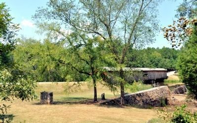
4. Watson Mill Bridge Marker
Note the marker to the left, and stone foundations and ponds to the right.
Watson Mill Covered Bridge image. Click for full size.
Photographed By David Seibert, September 22, 2007
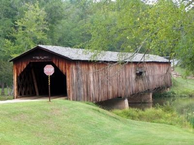
5. Watson Mill Covered Bridge
The bridge spans the South Fork, Broad River
Watson Mill Covered Bridge image. Click for full size.
Photographed By David Seibert, September 3, 2011
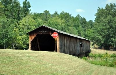
6. Watson Mill Covered Bridge
Watson Mill Covered Bridge image. Click for full size.
Photographed By David Seibert, September 3, 2011
7. Watson Mill Covered Bridge
Watson Mill Covered Bridge image. Click for full size.
Photographed By David Seibert, September 3, 2011
8. Watson Mill Covered Bridge
Watson Mill Covered Bridge image. Click for full size.
Photographed By David Seibert, September 3, 2011
9. Watson Mill Covered Bridge
Watson Mill Bridge<BR>Southwest Entrance image. Click for full size.
Photographed By Brian Scott, October 4, 2014
10. Watson Mill Bridge
Southwest Entrance
Watson Mill Runoff image. Click for full size.
Photographed By Brian Scott, October 4, 2014
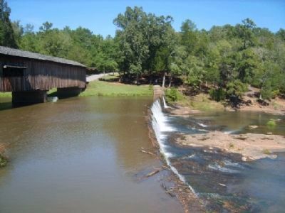
11. Watson Mill Runoff
Shoals Downstream from Watson Mill Bridge image. Click for full size.
Photographed By Brian Scott, October 4, 2014
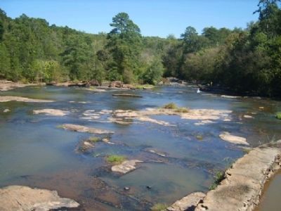
12. Shoals Downstream from Watson Mill Bridge
Paddle Boat Area image. Click for full size.
Photographed By Brian Scott, October 4, 2014
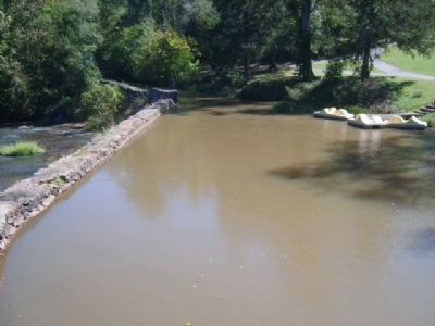
13. Paddle Boat Area
 
 
Credits. This page was last revised on June 16, 2016. It was originally submitted on September 18, 2011, by David Seibert of Sandy Springs, Georgia. This page has been viewed 1,195 times since then and 44 times this year. Photos:   1, 2, 3, 4, 5, 6, 7, 8, 9. submitted on September 18, 2011, by David Seibert of Sandy Springs, Georgia.   10, 11, 12, 13. submitted on October 26, 2014, by Brian Scott of Anderson, South Carolina. • Bill Pfingsten was the editor who published this page.
Share this page.  
Share on Tumblr
m=47310

CeraNet Cloud Computing sponsors the Historical Marker Database.
This website earns income from purchases you make after using our links to Amazon.com. We appreciate your support.
Paid Advertisement
Apr. 26, 2024