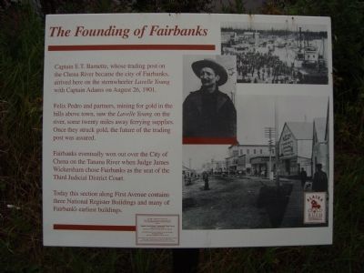
The Founding of Fairbanks
Captain E.T. Barnette, whose trading post on the Chena River became the city of Fairbanks, arrived here on the sternwheeler Lavelle Young with Captain Adams on August 26, 1901.
Felix Pedro and partners, mining for gold in the hills above town, saw the Lavelle Young on the river, some twenty miles away ferrying supplies. Once they struck gold, the future of the trading post was assured.
Fairbanks eventually won out over the City of Chena on the Tanana River when Judge Wickersham chose Fairbanks as the seat of the Third Judicial District Court.
Today this section along First Avenue contains three National Register Buildings and many of Fairbanks earliest buildings.
This sign s a product of a grant to the Chena Riverfront Commission, a commission of the City of Fairbanks, Fairbanks, North Star Borough, from the Alaska Gold Rush Centennial Task Force, Alaska Division of Tourism, Department of Commerce and Economic Development.
Alaska Gold Rush Centennial
Erected by Alaska Gold Rush Centennial Task Force.
Topics. This historical marker is listed in these topic lists: Industry & Commerce • Settlements & Settlers. A significant historical year for this entry is 1901.
Location. 64° 50.642′ N, 147° 43.413′ W. Marker is in Fairbanks, Alaska
Other nearby markers. At least 8 other markers are within walking distance of this marker. Barnette's Landing (about 400 feet away, measured in a direct line); Immaculate Conception Church (about 500 feet away); Fairbanks Public Schools (approx. 0.2 miles away); Cushman Street (approx. 0.2 miles away); "The Line" (approx. 0.2 miles away); Lacey Street Theater (1939) (approx. 0.2 miles away); Wickersham Cabin (approx. ¼ mile away); Suter House (approx. 0.3 miles away). Touch for a list and map of all markers in Fairbanks.
Also see . . . E. T. Barnette - Wikipedia. (Submitted on September 19, 2011, by Barry Swackhamer of Brentwood, California.)
Credits. This page was last revised on March 17, 2020. It was originally submitted on September 19, 2011, by Barry Swackhamer of Brentwood, California. This page has been viewed 687 times since then and 16 times this year. Photos: 1, 2. submitted on September 19, 2011, by Barry Swackhamer of Brentwood, California. • Bill Pfingsten was the editor who published this page.

