Alpine in Bergen County, New Jersey — The American Northeast (Mid-Atlantic)
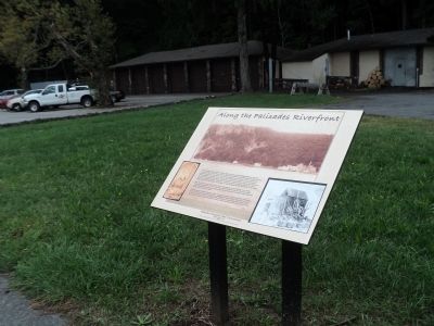
Along the Palisades Riverfront
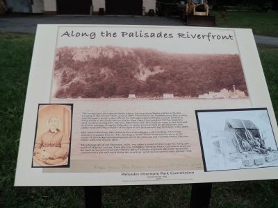
The background photograph shows Alpine Landing – here – known earlier as Closter Landing or the Closter Dock – around 1897. From before the Revolutionary War, a steep road through a break in the cliffs of the Palisades allowed Bergen County farmers to bring goods to the docks here to ship to New York City’s markets. In time boatmen, dock workers, quarrymen, laborers, fishermen – and their families – came to live here and at similar landings along the Palisades. A steam-powered mill for grinding oats and coffee beans (the big complex at the right of the photograph) was built here in the 1860s.
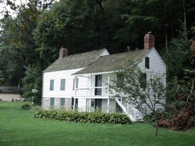
Mrs. Rachel Kearney, left, raised at least nine children at the landing. After being widowed a second time in 1831, she kept a tavern at her house (this house is at the center of the background photograph and is the only one still standing today). She was ninety when she died in 1870.
The photograph of eel fishermen, right, was taken around 1910 at Cape Fly Away, just north of Alpine Landing. Even after the Palisades Interstate Park Commission acquired the land in the early twentieth century, many Palisades residents – like these fishermen – continued to live and work along the riverfront, until the last moved away around 1930.
Erected 2009 by Palisades Interstate Park Commission.
Topics. This historical marker is listed in this topic list: Notable Places. A significant historical year for this entry is 1897.
Location. 40° 56.77′ N, 73° 55.122′ W. Marker is in Alpine, New Jersey, in Bergen County. Marker can be reached from Alpine Approach Road. Marker is in the Palisades Interstate Park at the end of the Alpine Approach Road, north of the Alpine Boat Basin. Touch for map. Marker is in this post office area: Alpine NJ 07620, United States of America. Touch for directions.
Other nearby markers. At least 8 other markers are within 2 miles of this marker, measured as the crow flies. Cornwallis Headquarters (about 400 feet away, measured in a direct line); The Old Alpine Trail (about 400 feet away); Untangling Folklore from Fact (about 400 feet away); Alpine Community Church (approx. 0.4 miles away); Closter Dock Road (approx. 0.4 miles away); 1776: British Invasion of New Jersey (approx. 1.1 miles away); Rionda’s Tower (approx. 1.1 miles away); Lower Closter or New Dock (approx. 1.4 miles away). Touch for a list and map of all markers in Alpine.
Also see . . . Palisades Interstate Park website. (Submitted on September 24, 2011, by Bill Coughlin of Woodland Park, New Jersey.)
Credits. This page was last revised on June 16, 2016. It was originally submitted on September 24, 2011, by Bill Coughlin of Woodland Park, New Jersey. This page has been viewed 885 times since then and 31 times this year. Photos: 1, 2, 3, 4. submitted on September 24, 2011, by Bill Coughlin of Woodland Park, New Jersey.


